MyTopo
Maywood Missouri US Topo Map
Couldn't load pickup availability
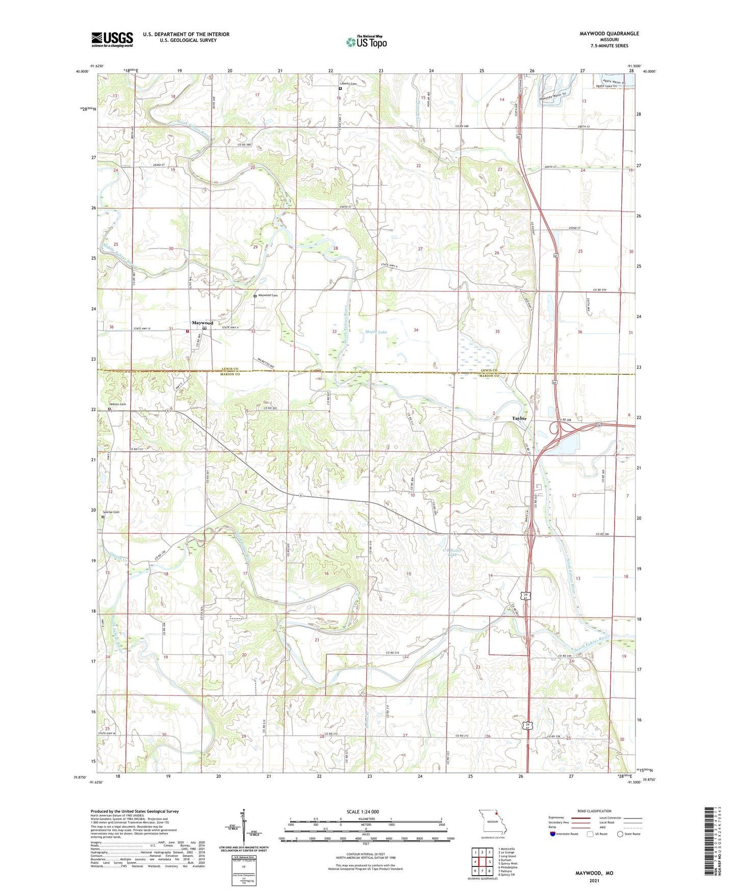
2021 topographic map quadrangle Maywood in the state of Missouri. Scale: 1:24000. Based on the newly updated USGS 7.5' US Topo map series, this map is in the following counties: Marion, Lewis. The map contains contour data, water features, and other items you are used to seeing on USGS maps, but also has updated roads and other features. This is the next generation of topographic maps. Printed on high-quality waterproof paper with UV fade-resistant inks.
Quads adjacent to this one:
West: Durham
Northwest: Monticello
North: La Grange
Northeast: Long Island
East: Quincy West
Southeast: Quincy SW
South: Palmyra
Southwest: Philadelphia
This map covers the same area as the classic USGS quad with code o39091h5.
Contains the following named places: Bethel Branch, Bimson Dam, C B Keller Lake, Franklin School, Grassy Creek, Haerr Field, Hebron Cemetery, Hebron Church, Hebron School, Keller Lake Dam, Lavingon Dam, Liberty Cemetery, Liberty Church, Liberty School, Maple Lake, Maywood, Maywood Cemetery, Maywood Post Office, Middle Fabius River, North Fabius River, Oakview School, Olivet Church, R - 4 Fire Protection District Station 2 Maywood, Scott School, Shannon School, South Fabius River, Sudduth School, Sunrise Cemetery, Taylor, Taylor Post Office, Township of Fabius, Troublesome Creek, Walnut Grove School