MyTopo
Leonard Missouri US Topo Map
Couldn't load pickup availability
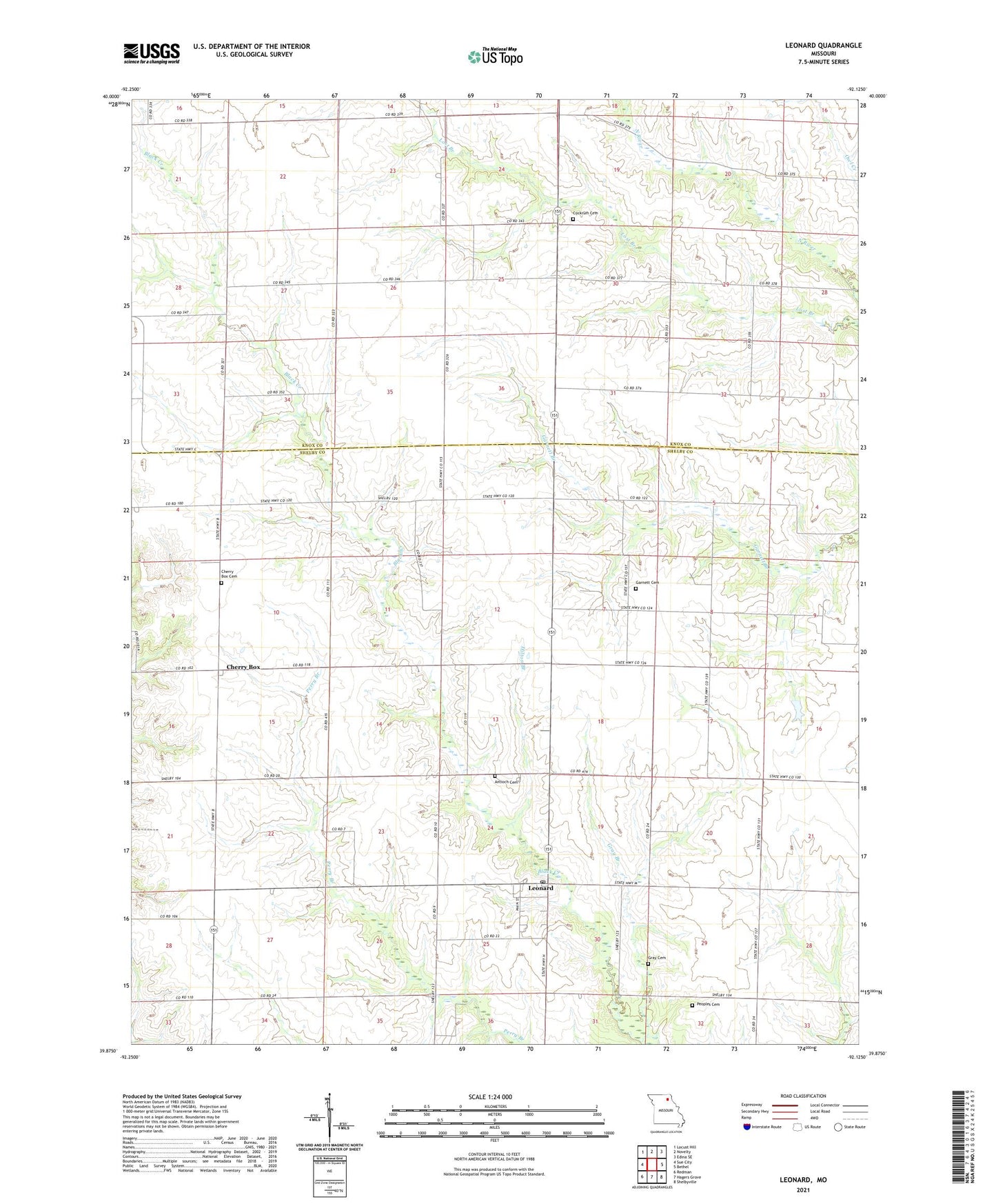
2021 topographic map quadrangle Leonard in the state of Missouri. Scale: 1:24000. Based on the newly updated USGS 7.5' US Topo map series, this map is in the following counties: Shelby, Knox. The map contains contour data, water features, and other items you are used to seeing on USGS maps, but also has updated roads and other features. This is the next generation of topographic maps. Printed on high-quality waterproof paper with UV fade-resistant inks.
Quads adjacent to this one:
West: Sue City
Northwest: Locust Hill
North: Novelty
Northeast: Edina SE
East: Bethel
Southeast: Shelbyville
South: Hagers Grove
Southwest: Redman
Contains the following named places: Antioch Cemetery, Browning Lake Dam, Caldwell Lake Section 6 Dam, Caldwell Lake Section 7 Dam, Cherry Box, Cherry Box Cemetery, Cherry Box School, Church of the Brethren, Cockrum Cemetery, Fairview School, Garnett Cemetery, Gray Branch, Gray Cemetery, Gray School, Grubb College School, Hilton Branch, Leonard, Leonard Christian Church, Leonard Post Office, McWilliams School, Mennonite Church, Millers Mill, Mote School, New Providence Church, Peoples Cemetery, Rhoades School, Shortfall School, Township of Taylor, Village of Leonard, Washington School, ZIP Codes: 63451, 63460