MyTopo
Lewistown Missouri US Topo Map
Couldn't load pickup availability
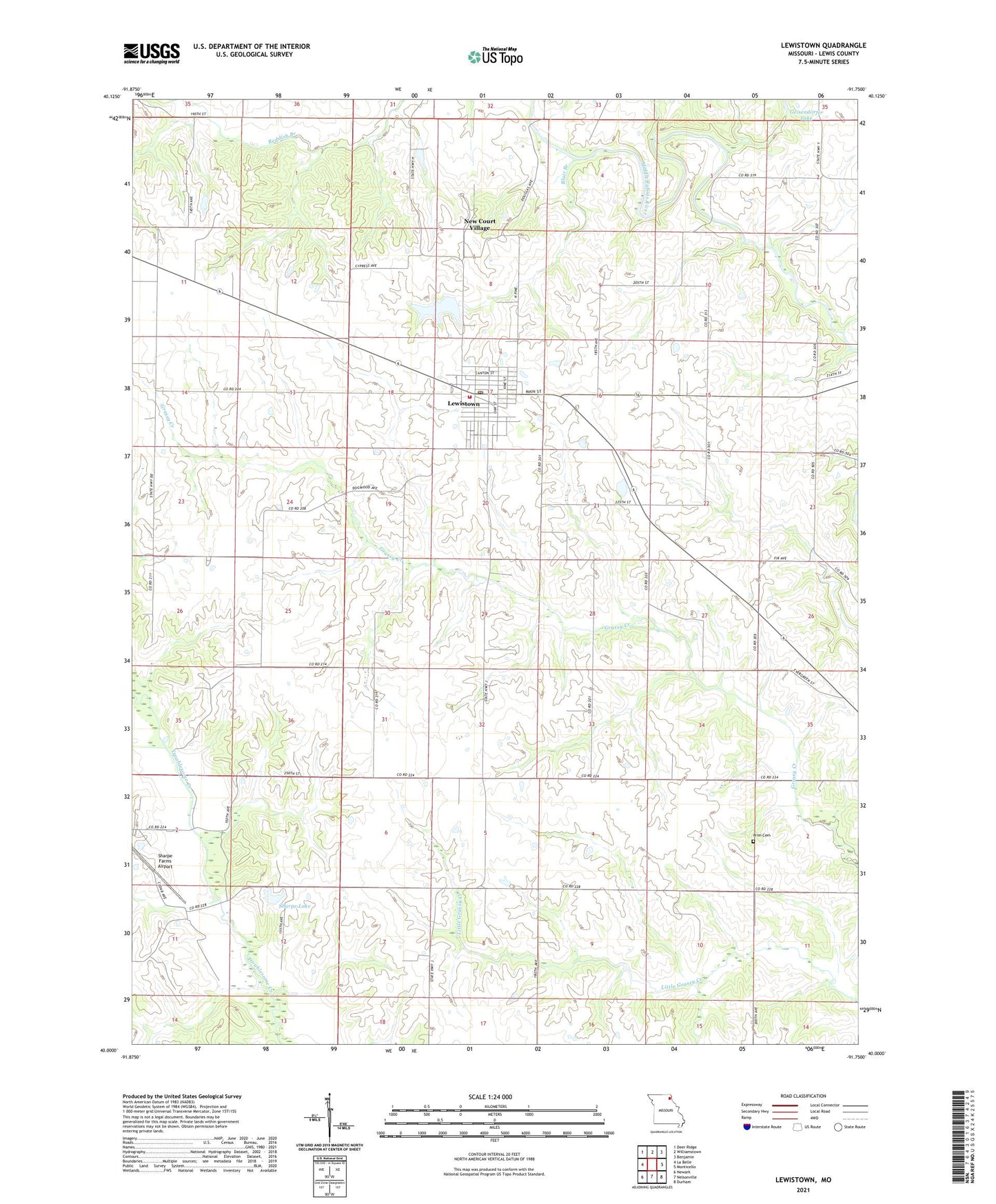
2021 topographic map quadrangle Lewistown in the state of Missouri. Scale: 1:24000. Based on the newly updated USGS 7.5' US Topo map series, this map is in the following counties: Lewis. The map contains contour data, water features, and other items you are used to seeing on USGS maps, but also has updated roads and other features. This is the next generation of topographic maps. Printed on high-quality waterproof paper with UV fade-resistant inks.
Quads adjacent to this one:
West: La Belle
Northwest: Deer Ridge
North: Williamstown
Northeast: Benjamin
East: Monticello
Southeast: Durham
South: Nelsonville
Southwest: Newark
Contains the following named places: Baker Dam, Baker Lake, Blair Branch, City of Lewistown Dam, City of Lewistown Reservoir, Geisendorfer Lake, Geisendorfer Lake Dam, Glaves School, Jerusalem, Lewistown, Lewistown Post Office, Lewistown Volunteer Fire Department, Luttrell Farms Dam, Luttrell Farms Lake, New Court Village, Oakland School, Phillips Airport, Prim Cemetery, Sharpe Lake, Sharpe Lake Dam, Town of Lewistown, Township of La Belle, Turner School, ZIP Code: 63452