MyTopo
Buffalo Missouri US Topo Map
Couldn't load pickup availability
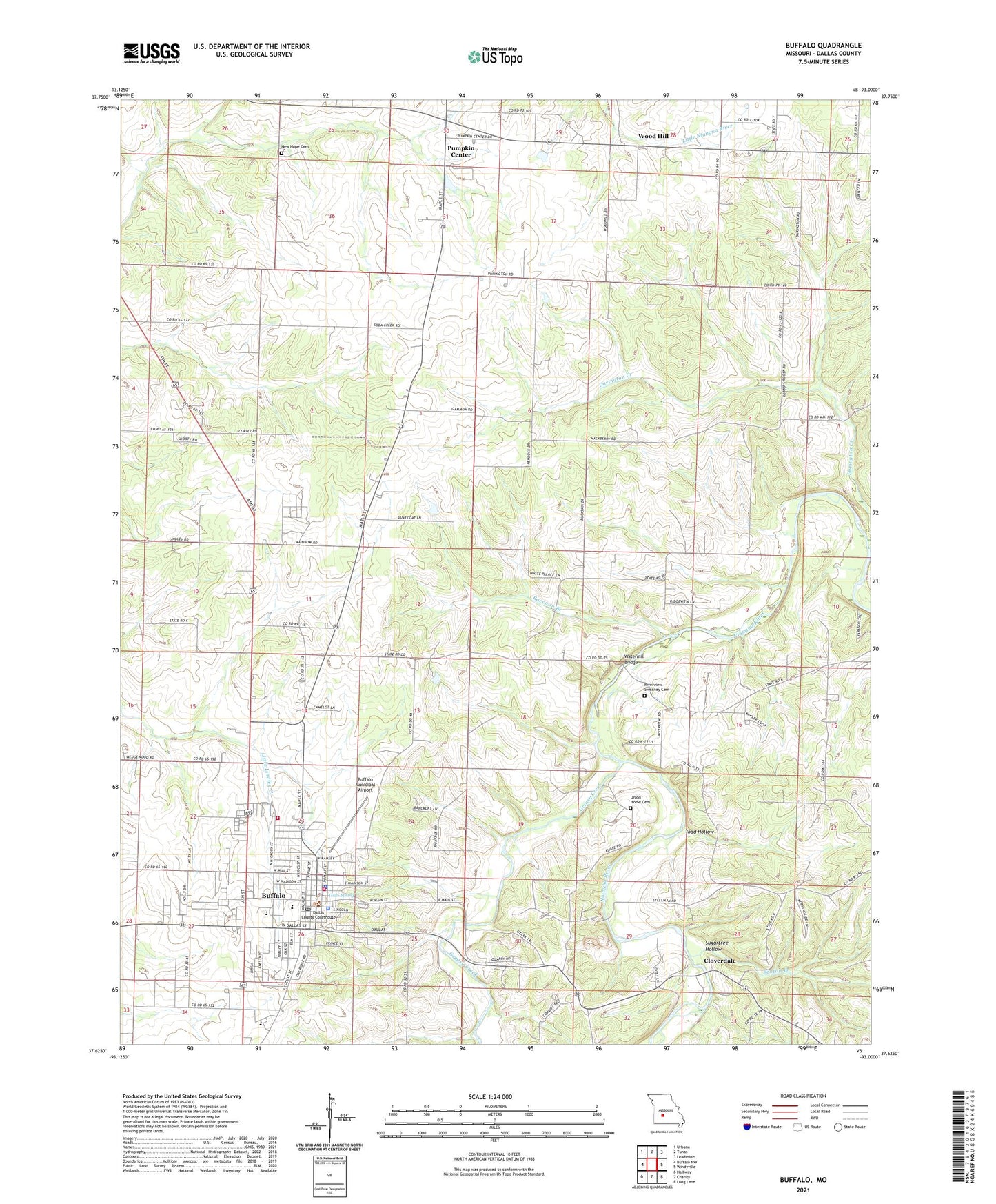
2021 topographic map quadrangle Buffalo in the state of Missouri. Scale: 1:24000. Based on the newly updated USGS 7.5' US Topo map series, this map is in the following counties: Dallas. The map contains contour data, water features, and other items you are used to seeing on USGS maps, but also has updated roads and other features. This is the next generation of topographic maps. Printed on high-quality waterproof paper with UV fade-resistant inks.
Quads adjacent to this one:
West: Buffalo NW
Northwest: Urbana
North: Tunas
Northeast: Leadmine
East: Windyville
Southeast: Long Lane
South: Charity
Southwest: Halfway
This map covers the same area as the classic USGS quad with code o37093f1.
Contains the following named places: Benton Branch School, Boodler School, Buffalo, Buffalo City Fire and Rescue, Buffalo Municipal Airport, Buffalo Police Department, Buffalo Post Office, Buffalo Rural Fire Department Station 1, City of Buffalo, Cloverdale, Cotter Tabernacle, Cowden School, Dallas County, Dallas County Sheriff's Office, Engle School, Gammon School, Greasy Creek, Gum Spring, KBFL-FM (Buffalo), Mountain View School, New Hope Cemetery, New Hope Church, Olive Branch School, Pumpkin Center, Raccoon Branch, Riverview - Sweaney Cemetery, Riverview Church, Sugartree Hollow, Todd Hollow, Township of North Benton, Union Home Cemetery, Watermill Bridge, White Palace School, Wood Hill, Wood Hill School, ZIP Code: 65622