MyTopo
Marquand Missouri US Topo Map
Couldn't load pickup availability
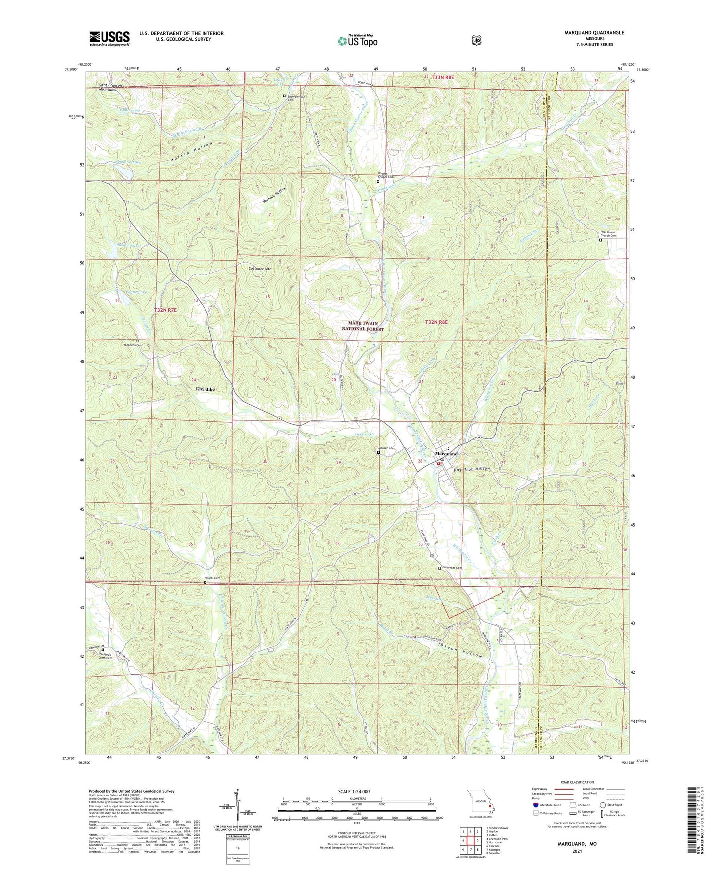
2021 topographic map quadrangle Marquand in the state of Missouri. Scale: 1:24000. Based on the newly updated USGS 7.5' US Topo map series, this map is in the following counties: Madison, Bollinger. The map contains contour data, water features, and other items you are used to seeing on USGS maps, but also has updated roads and other features. This is the next generation of topographic maps. Printed on high-quality waterproof paper with UV fade-resistant inks.
Quads adjacent to this one:
West: Cherokee Pass
Northwest: Fredericktown
North: Higdon
Northeast: Patton
East: Hurricane
Southeast: Glenallen
South: Allbright
Southwest: Cascade
Contains the following named places: Aslinger Branch, Big Four School, Brown Lake, Canaan Camp, City of Marquand, Cornwall Church, Cottoner Mountain, Cozean Mine, Dog Trot Hollow, East Prong Shetley Creek, Greasy Creek, Greasy Creek School, Grounds Creek, Henderson Creek, Indian Creek, Joseph Hollow, Klendike, Leaky Lake, Marquand, Marquand Post Office, Marquand Volunteer Fire Department, Martin Hollow, Mountain View Church, Mouser Cemetery, Mouser School, Myers Branch, Neville Dam, Newman Lake, Newman Lake Dam, Pine Union Church, Pine Union School, Pogue Lake, Pogue Lake Dam, Pond Branch, Rhodes Chapel, Shetley Creek Church, Shetley Creek School, Smittys Catfish Pond Dam, Snowden Branch, Snowdenville School, Starkey Mine, Stephens Cemetery, Stevens Branch, Tiptop School, Township of Marquand, Vernum Hollow, Walnut Grove Church, Wash Creek, White Spring, White Spring Branch, Whitener Cemetery, Whitener Creek, Whiteners Creek, Wright Chapel, Younts Cemetery, ZIP Code: 63655