MyTopo
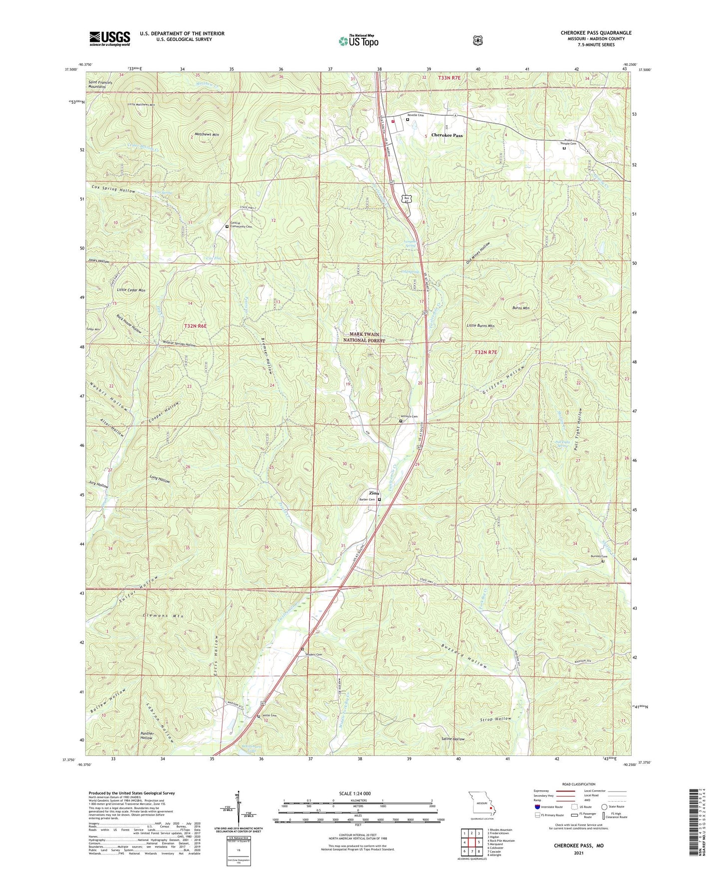
Cherokee Pass Missouri US Topo Map
Couldn't load pickup availability
Also explore the Cherokee Pass Forest Service Topo of this same quad for updated USFS data
2021 topographic map quadrangle Cherokee Pass in the state of Missouri. Scale: 1:24000. Based on the newly updated USGS 7.5' US Topo map series, this map is in the following counties: Madison. The map contains contour data, water features, and other items you are used to seeing on USGS maps, but also has updated roads and other features. This is the next generation of topographic maps. Printed on high-quality waterproof paper with UV fade-resistant inks.
Quads adjacent to this one:
West: Rock Pile Mountain
Northwest: Rhodes Mountain
North: Fredericktown
Northeast: Higdon
East: Marquand
Southeast: Allbright
South: Cascade
Southwest: Coldwater
This map covers the same area as the classic USGS quad with code o37090d3.
Contains the following named places: Altar Hollow, Antioch Cemetery, Antioch Church, Barber Cemetery, Bremser Hollow, Burnley Cemetery, Burns Mountain, Buzzard Hollow, Central, Central Church, Central School, Cherokee Pass, Cherokee Pass Census Designated Place, Cherokee Pass Volunteer Fire Department Station 1, Clemons Mountain, Cold Spring, Cooper Hollow, Cox Flat, Cox Spring, Ebenezer Church, Ebenezer School, Ellis Hollow, Griffon Hollow, Jury Hollow, Labron Hollow, Lampher Spring, Little Burns Mountain, Little Cedar Mountain, Little Matthews Mountain, London Hill Church, Long Hollow, Madison County, Matthews Mountain, Miller Chapel, Miller Chapel School, Nesbit Hollow, Oak Hill Church, Old Mines Hollow, Peters Creek, Pull Tight Hollow, Pull Tight Spring, Revelle Cemetery, Rock House Hollow, Sanders Cemetery, Settle Cemetery, Strop Hollow, Township of Central, Twelvemile Church, Twelvemile Store, Whitehurst Lake, Whitehurst Lake Dam, Wildcat Springs Hollow, Zion, Zion School