MyTopo
Memphis Missouri US Topo Map
Couldn't load pickup availability
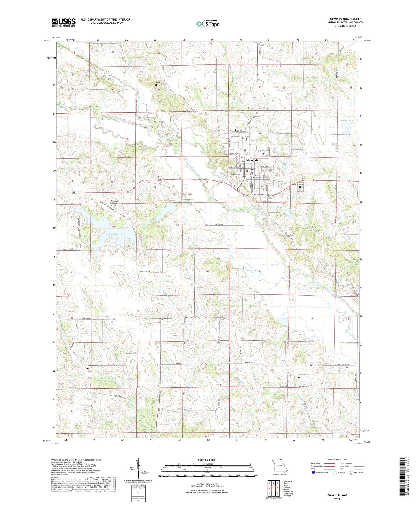
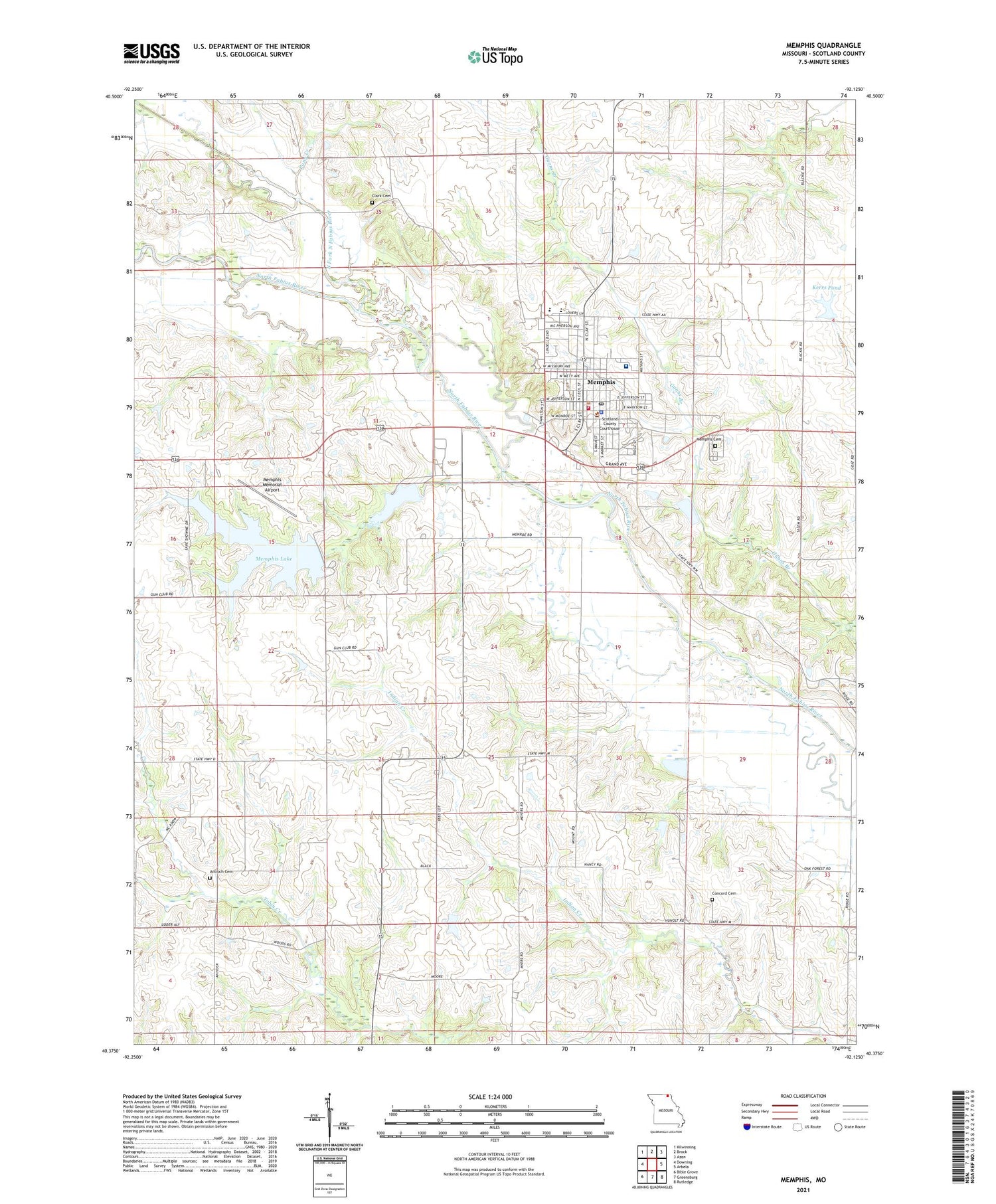
2021 topographic map quadrangle Memphis in the state of Missouri. Scale: 1:24000. Based on the newly updated USGS 7.5' US Topo map series, this map is in the following counties: Scotland. The map contains contour data, water features, and other items you are used to seeing on USGS maps, but also has updated roads and other features. This is the next generation of topographic maps. Printed on high-quality waterproof paper with UV fade-resistant inks.
Quads adjacent to this one:
West: Downing
Northwest: Kilwinning
North: Brock
Northeast: Azen
East: Arbela
Southeast: Rutledge
South: Greensburg
Southwest: Bible Grove
Contains the following named places: Antioch Cemetery, Antioch Church, City of Memphis, Clark Cemetery, Concord Cemetery, Concord Church, Edinburg School, Hazel Dell School, Jayne School, Kerr Dam, Kerrs Pond, KMEM-FM (Memphis), Memphis, Memphis Cemetery, Memphis Country Club, Memphis Fire Department, Memphis Lake, Memphis Lake and Park Dam, Memphis Memorial Airport, Memphis Police Department, Memphis Post Office, Memphis Reservoir, Memphis Reservoir Dam, Meyers Lake Dam, Miller and Sons Lake Dam, Miller School, Mount Adow Church, Nauvoo, North Fork North Fabius River, North Liberty School, Oak Forest School, Oakridge Church, Pony Creek, Scotland County, Scotland County Hospital, Scotland County Rural Fire Department, Scotland County Sheriff's Office, Township of Jefferson, White School, ZIP Code: 63555