MyTopo
Montreal Missouri US Topo Map
Couldn't load pickup availability
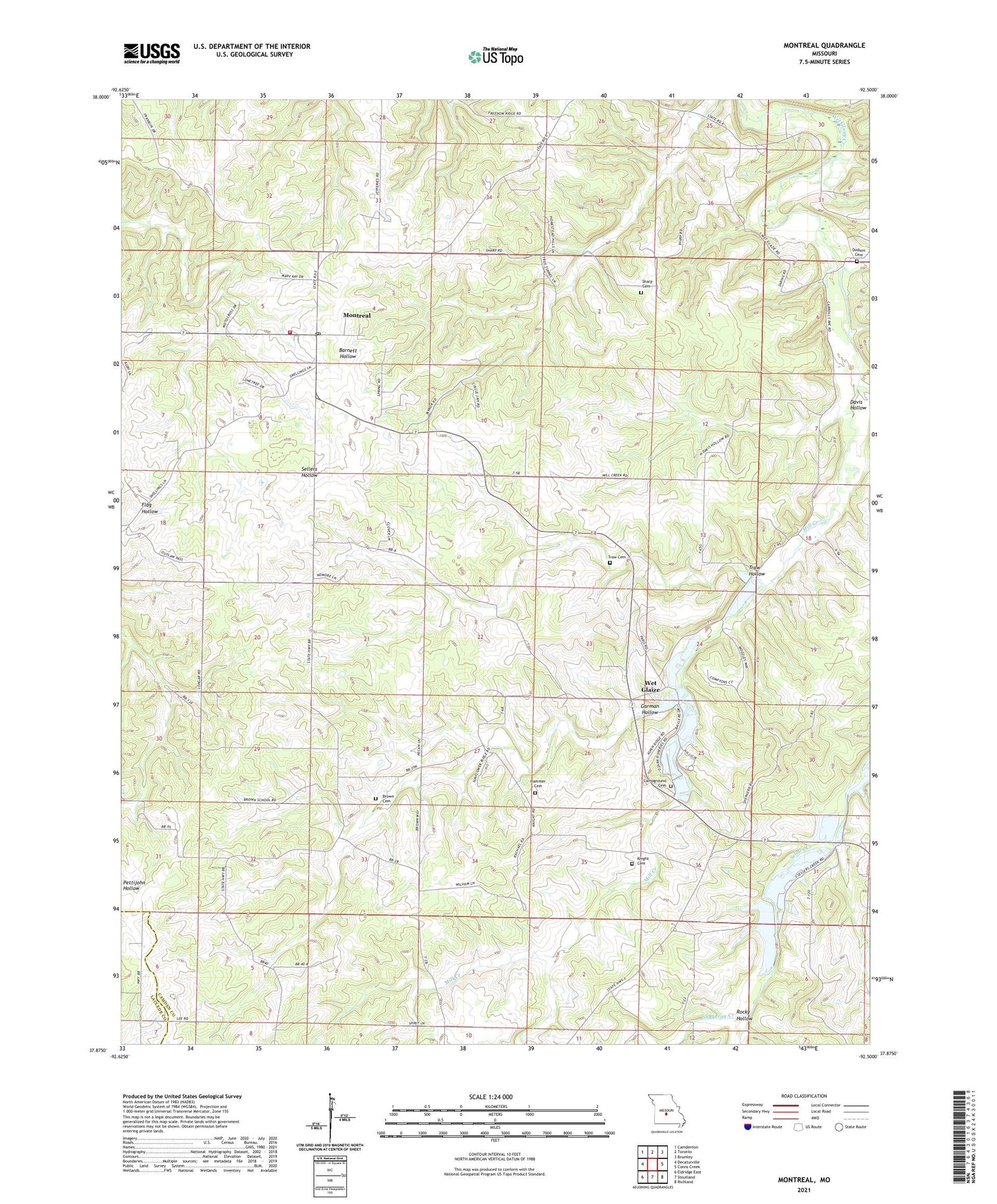
2021 topographic map quadrangle Montreal in the state of Missouri. Scale: 1:24000. Based on the newly updated USGS 7.5' US Topo map series, this map is in the following counties: Camden, Laclede. The map contains contour data, water features, and other items you are used to seeing on USGS maps, but also has updated roads and other features. This is the next generation of topographic maps. Printed on high-quality waterproof paper with UV fade-resistant inks.
Quads adjacent to this one:
West: Decaturville
Northwest: Camdenton
North: Toronto
Northeast: Brumley
East: Conns Creek
Southeast: Richland
South: Stoutland
Southwest: Eldridge East
Contains the following named places: Brown Cemetery, Browns School, Buffalo Prairie Church, Campground Cemetery, Campground Church, Davis Hollow, Demeter, Dodson Cemetery, Garman Hollow, Garman School, Hammer Cemetery, High Point Church, Independence School, Knight Cemetery, Mid - County Fire Protection District Station 4, Mill Creek, Montreal, Montreal Census Designated Place, Montreal Post Office, Ozark Fish Hatcheries, Ozark Fisheries Dam, Rocky Hollow, Shakerag Creek, Sharp Cemetery, Stoutland Creek, Sunnyside Church, Sweatt School, Township of Auglaize, Traw Cemetery, Traw Hollow, Wet Glaize, Wet Glaize Census Designated Place