MyTopo
Myrtle Missouri US Topo Map
Couldn't load pickup availability
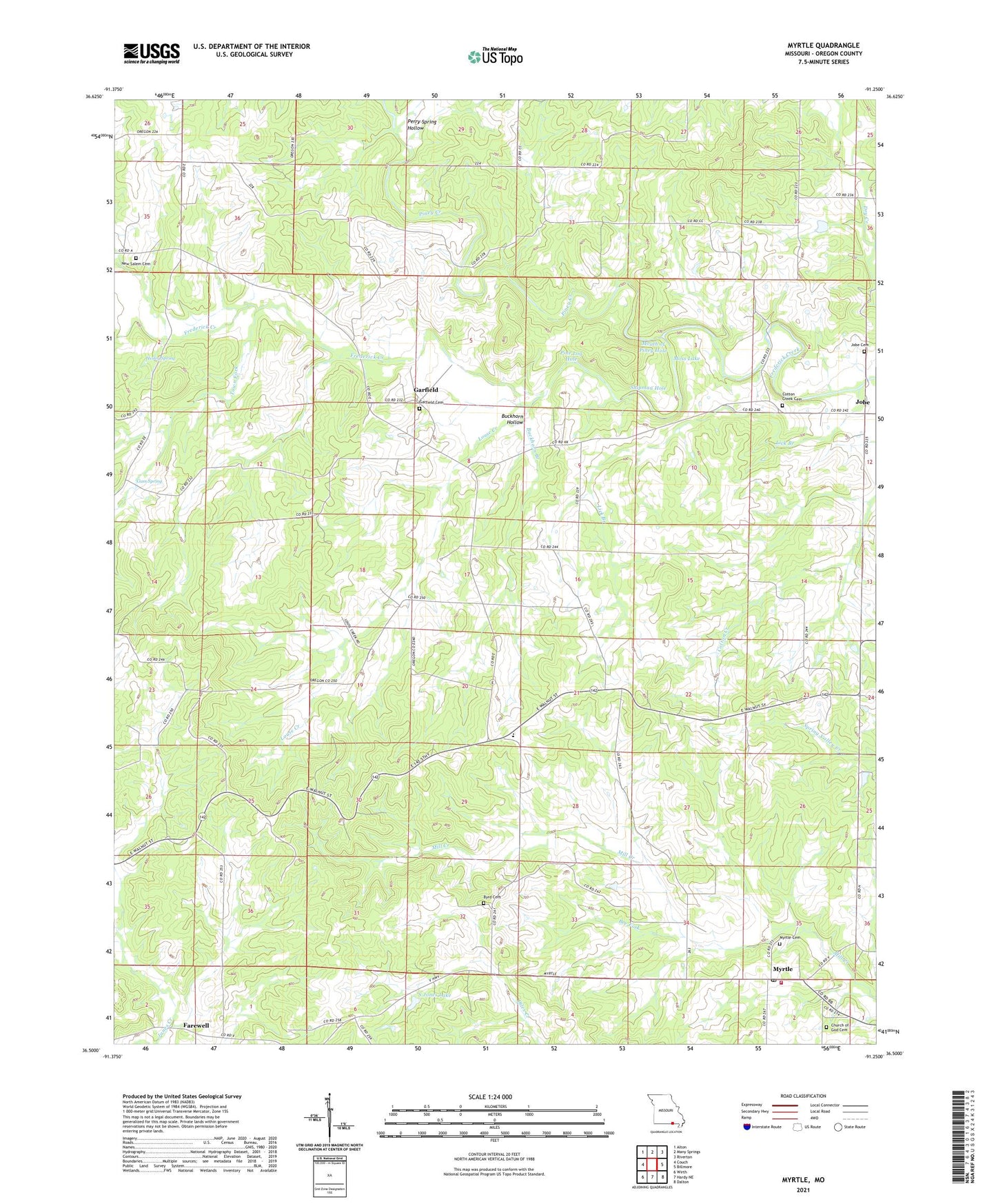
2021 topographic map quadrangle Myrtle in the state of Missouri. Scale: 1:24000. Based on the newly updated USGS 7.5' US Topo map series, this map is in the following counties: Oregon. The map contains contour data, water features, and other items you are used to seeing on USGS maps, but also has updated roads and other features. This is the next generation of topographic maps. Printed on high-quality waterproof paper with UV fade-resistant inks.
Quads adjacent to this one:
West: Couch
Northwest: Alton
North: Many Springs
Northeast: Riverton
East: Billmore
Southeast: Dalton
South: Hardy NE
Southwest: Wirth
Contains the following named places: Bee Fork, Bird School, Booker Pond, Buckhorn Branch, Buckhorn Hollow, Byrd Cemetery, Byrd Church, Cave Lake, Center Point Church, Church of God Chapel, Community Church, Cotton Creek Cemetery, Cotton Creek Church, Cotton Creek School, Couch Schools, Deckard-Y, Dellhalf Church, Elmer Shaw Junior Lake, Farewell, First Baptist Church, Freewill Baptist Church, Frey Ford, Frey Lake, Garfield, Garfield Church, Garfield School, Guiteau, Guiteau Church, Guiteau School, Gum Spring, Hesley Spring, Hughes Lake, Jobe, Jobe Cemetery, Lick Branch, Louse Creek, Moss Lake, Mouth of Piney Hole, Myrtle, Myrtle Post Office, Myrtle Volunteer Fire Department, New Salem Cemetery, New Salem Church, New Salem School, O'Neal Lake, Perry Spring Hollow, Pine Log Hole, Piney Church, Piney Creek, Piney School, Pleasant Grove School, Rocky Hole, S Jones Lake, S Jones Lake Dam, Shaw Lake Dam, Shipman Hole, Town Fork, Township of Jobe, Township of Myrtle, ZIP Codes: 65690, 65778