MyTopo
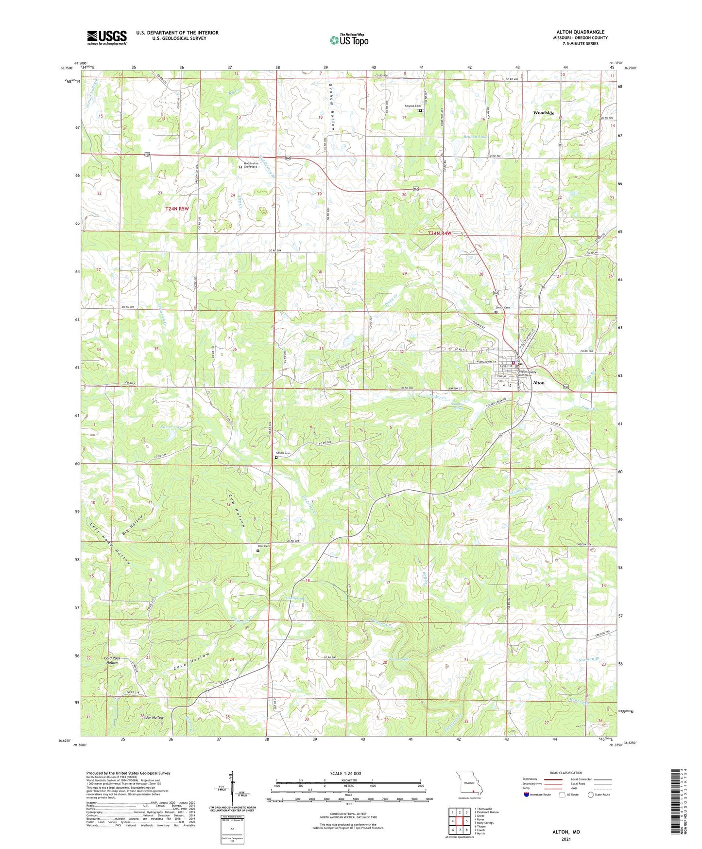
Alton Missouri US Topo Map
Couldn't load pickup availability
2021 topographic map quadrangle Alton in the state of Missouri. Scale: 1:24000. Based on the newly updated USGS 7.5' US Topo map series, this map is in the following counties: Oregon. The map contains contour data, water features, and other items you are used to seeing on USGS maps, but also has updated roads and other features. This is the next generation of topographic maps. Printed on high-quality waterproof paper with UV fade-resistant inks.
Quads adjacent to this one:
West: Rover
Northwest: Thomasville
North: Piedmont Hollow
Northeast: Greer
East: Many Springs
Southeast: Myrtle
South: Couch
Southwest: Thayer
This map covers the same area as the classic USGS quad with code o38090h2.
Contains the following named places: Alton, Alton Fire Department, Alton High School, Alton Police Department, Bennett Lake, Big Hollow, Cave Hollow, City of Alton, Climax Church, Cow Hollow, Culp Branch, Dills Cemetery, Fairview School, Hall Branch, Hix Lake Dam, Huddleston, Huddleston Branch, Huddleston Church, Huddleston Graveyard, Left Hand Hollow, Missouri Department of Conservation Forestry Ozark Regional Field Fire Office Alton, Mud Spring, Norman Spring, Nuwer Lake, Nuwer Lake Dam, Oregon County, Oregon County Sheriff's Office, Pennwood Church, Pinwood School, Royal Oak, Royal Oak Church, Royal Oak School, Shiloh Church, Shiloh School, Simpson Spring, Smith Cemetery, Smyrna Cemetery, Smyrna Church, Smyrna School, Township of Piney, Tucker Creek, Verlotta Dam, Victory Church, Woodside, Young Lake Dam