MyTopo
Parnell East Missouri US Topo Map
Couldn't load pickup availability
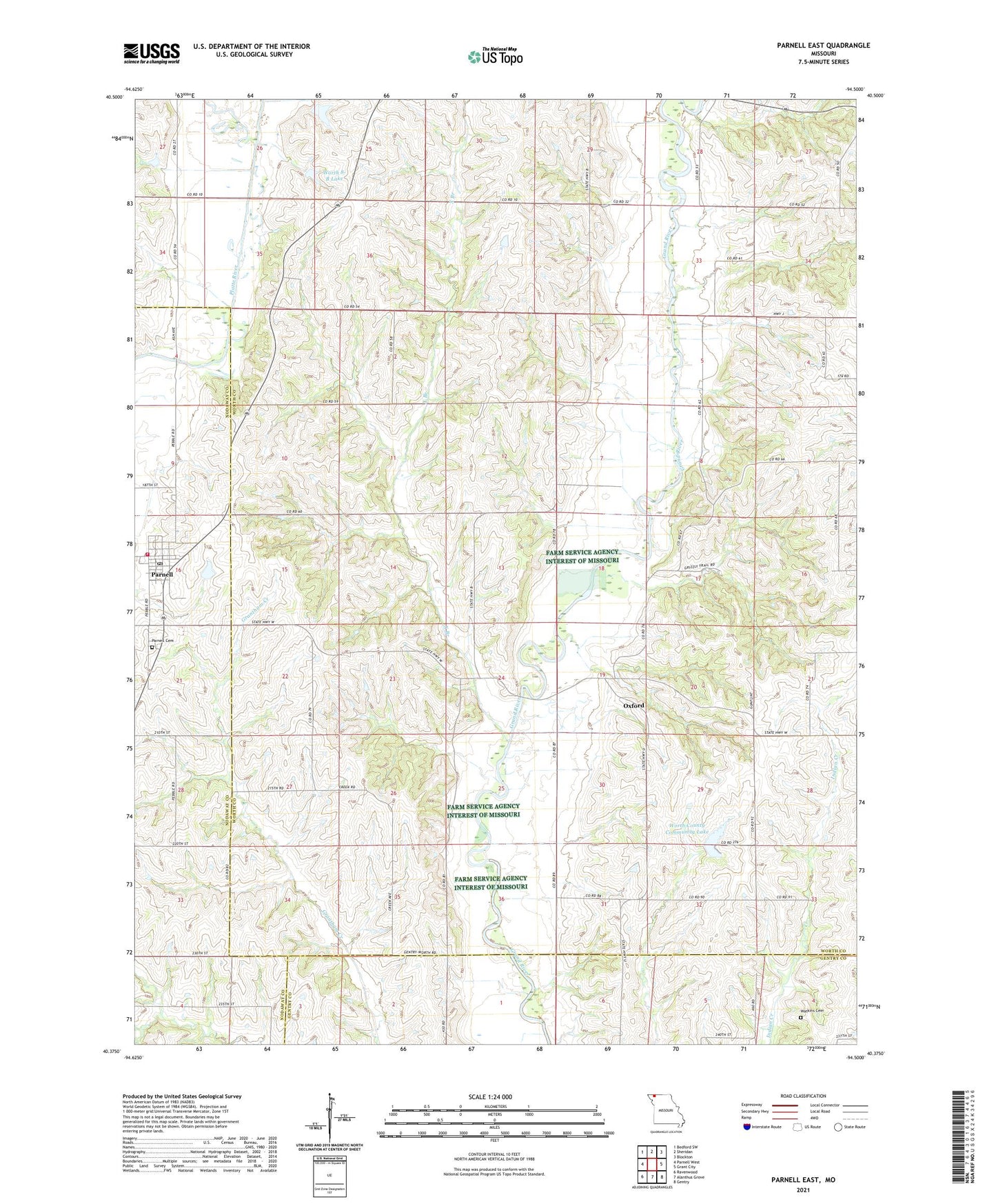
2021 topographic map quadrangle Parnell East in the state of Missouri. Scale: 1:24000. Based on the newly updated USGS 7.5' US Topo map series, this map is in the following counties: Worth, Nodaway, Gentry. The map contains contour data, water features, and other items you are used to seeing on USGS maps, but also has updated roads and other features. This is the next generation of topographic maps. Printed on high-quality waterproof paper with UV fade-resistant inks.
Quads adjacent to this one:
West: Parnell West
Northwest: Bedford SW
North: Sheridan
Northeast: Blockton
East: Grant City
Southeast: Gentry
South: Alanthus Grove
Southwest: Ravenwood
Contains the following named places: Batson School, Bethel Church, Champion Hill School, City of Parnell, Concord School, Echo Dell School, Grandview School, Miller School, Mount Evart School, Mount Vernon Church, Mount Zion School, Oxford, Parnell, Parnell Elementary School, Parnell Fire Protection District, Parnell Post Office, Platte River Tributaries Watershed Dam 7-B, Ponder Dam, Ponder Lake, Rose Hill Cemetery, Township of Greene, Watkins Cemetery, Worth 8-B Lake, Worth County Community Lake, Worth County Community Lake Dam, Worth County Community Lake State Recreation Area, X Branch, ZIP Code: 64475