MyTopo
Coldwater Missouri US Topo Map
Couldn't load pickup availability
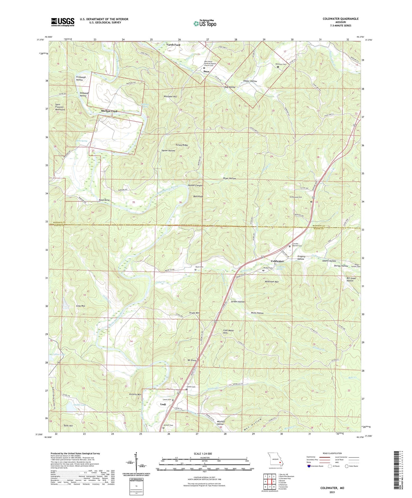
2023 topographic map quadrangle Coldwater in the state of Missouri. Scale: 1:24000. Based on the newly updated USGS 7.5' US Topo map series, this map is in the following counties: Madison, Wayne. The map contains contour data, water features, and other items you are used to seeing on USGS maps, but also has updated roads and other features. This is the next generation of topographic maps. Printed on high-quality waterproof paper with UV fade-resistant inks.
Quads adjacent to this one:
West: Brunot
Northwest: Des Arc NE
North: Rock Pile Mountain
Northeast: Cherokee Pass
East: Cascade
Southeast: Lowndes
South: Greenville
Southwest: Patterson
This map covers the same area as the classic USGS quad with code o37090c4.
Contains the following named places: Adams Hollow, Antioch Cemetery, Antioch Church, Bald Knob, Bennett Creek, Bill Goad Hollow, Camp Number 26, Cedar Creek, Cherokee Ridge Camp, Cold Water Hills, Coldwater, Coldwater Spring, Collier Creek, Collins Lake, Coon Creek, Dorsey Hollow, Dryer Hollow, Firebaugh Hollow, Gray Mountain, Greenwood Branch, Greenwood Cemetery, Gregory Hollow, Head Ford, Hunter Creek, Huzzah Canyon, Huzzah Creek, Jordon Hollow, Lewis Cemetery, Linville - Barrett Cemetery, Lodi, Lodi Nazarene Church, Marsh Ford, Mitchell Hollow, Mount Glory, New Home Church, Oak Dale Church, Otahki Lake, Otahki Lake Dam, Paullus Cemetery, Paullus School, Philis Hollow, Ray Hollow, Reed Bend, Reed Bend Ford, Reed Bend School, Rocky Grove Church, Rowland School, Saco, Seabaugh Hollow, Shafer Hollow, Shelton Ford, Short Cemetery, Spout Spring, Squaw Hollow, Stillhouse Spring, Strahl Mountain, Sutton Cemetery, Tater Hill, Township of Cedar Creek, Township of Twelvemile, Trace Creek, Turkey Ridge, Twelvemile Creek, Varsh Ford, Victoria Mountain, Wakefield Hollow, Whitaker Hill, Whitener Cemetery, Wilkinson Mountain, Wilmore Creek, ZIP Code: 63964