MyTopo
Richards Missouri US Topo Map
Couldn't load pickup availability
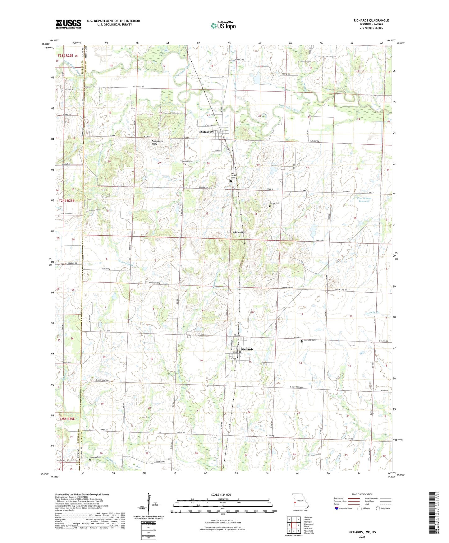
2021 topographic map quadrangle Richards in the state of Missouri. Scale: 1:24000. Based on the newly updated USGS 7.5' US Topo map series, this map is in the following counties: Vernon, Bourbon. The map contains contour data, water features, and other items you are used to seeing on USGS maps, but also has updated roads and other features. This is the next generation of topographic maps. Printed on high-quality waterproof paper with UV fade-resistant inks.
Quads adjacent to this one:
West: Hammond
Northwest: Prescott
North: Hume
Northeast: Sprague
East: Metz
Southeast: Moundville
South: Deerfield
Southwest: Fort Scott
Contains the following named places: Bitterroot Creek, Coleman Cemetery, Duncan Creek, East Liberty Cemetery, Enoch School, Fred Wilmot Dam, Fred Wilmot Reservoir, Hickman Hill, Jantz Dam, Jantz Reservoir, Kaufman Cemetery, McGinnis School, Mononame 308 Dam, Osage Plains, Pecan Creek, Richards, Richards Post Office, Richards Rural Fire Department, Richards School, Richland Cemetery, Rombaugh Hills, Stotesbury, Stotesbury School, Town of Richards, Town of Stotesbury, Township of Richland, Turley Cemetery, Wilmot and Steele Incorporated Lake Dam, Wolf Creek