MyTopo
Rosati Missouri US Topo Map
Couldn't load pickup availability
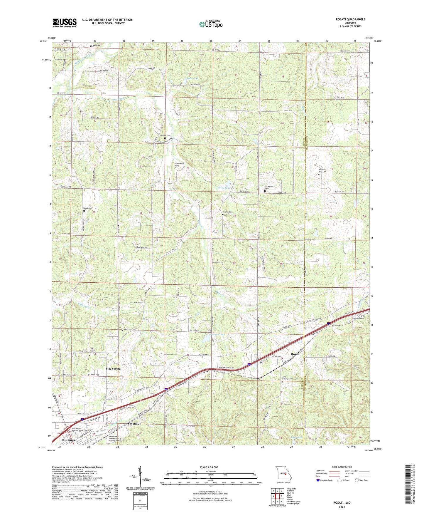
2021 topographic map quadrangle Rosati in the state of Missouri. Scale: 1:24000. Based on the newly updated USGS 7.5' US Topo map series, this map is in the following counties: Phelps, Crawford. The map contains contour data, water features, and other items you are used to seeing on USGS maps, but also has updated roads and other features. This is the next generation of topographic maps. Printed on high-quality waterproof paper with UV fade-resistant inks.
Quads adjacent to this one:
West: Safe
Northwest: High Gate
North: Redbird
Northeast: Oak Hill
East: Cuba
Southeast: Indian Springs
South: Maramec Spring
Southwest: Dillon
This map covers the same area as the classic USGS quad with code o38091a5.
Contains the following named places: Attebery - Fort Cemetery, Branstetter Cemetery, Campbell Cemetery, Cardetti Lake, Cardetti Lake Dam, Catholic Cemetery, City of Saint James, Clear Creek, Collins School, Dawson Cemetery, Dorey Iron Bank, Egan Lake, Egan Lake Dam, First Assembly of God Church, Flag Spring, Flag Spring Church, Flag Spring School, Flag Springs Cemetery, Foster Lake, Foster Lake Dam, Friendship School, Gronholt Cemetery, Hinkle, Hughes Cemetery, Immaculate Conception Catholic Cemetery, Miles Cemetery, Miles Church, Miles School, Pond Prairie, Preston Iron Mine, Rosati, Rosati Lookout Tower, Saint Anthony Cemetery, Saint James Hospital, Saint James Veterans Home Cemetery, Schundler, Schweitzer Cemetery, Seliga Lake, Seliga Lake Dam, Township of Dawson, Township of Saint James, Wash Cemetery, Wash School, ZIP Code: 65559