
MyTopo
Sikeston North Missouri US Topo Map
Couldn't load pickup availability
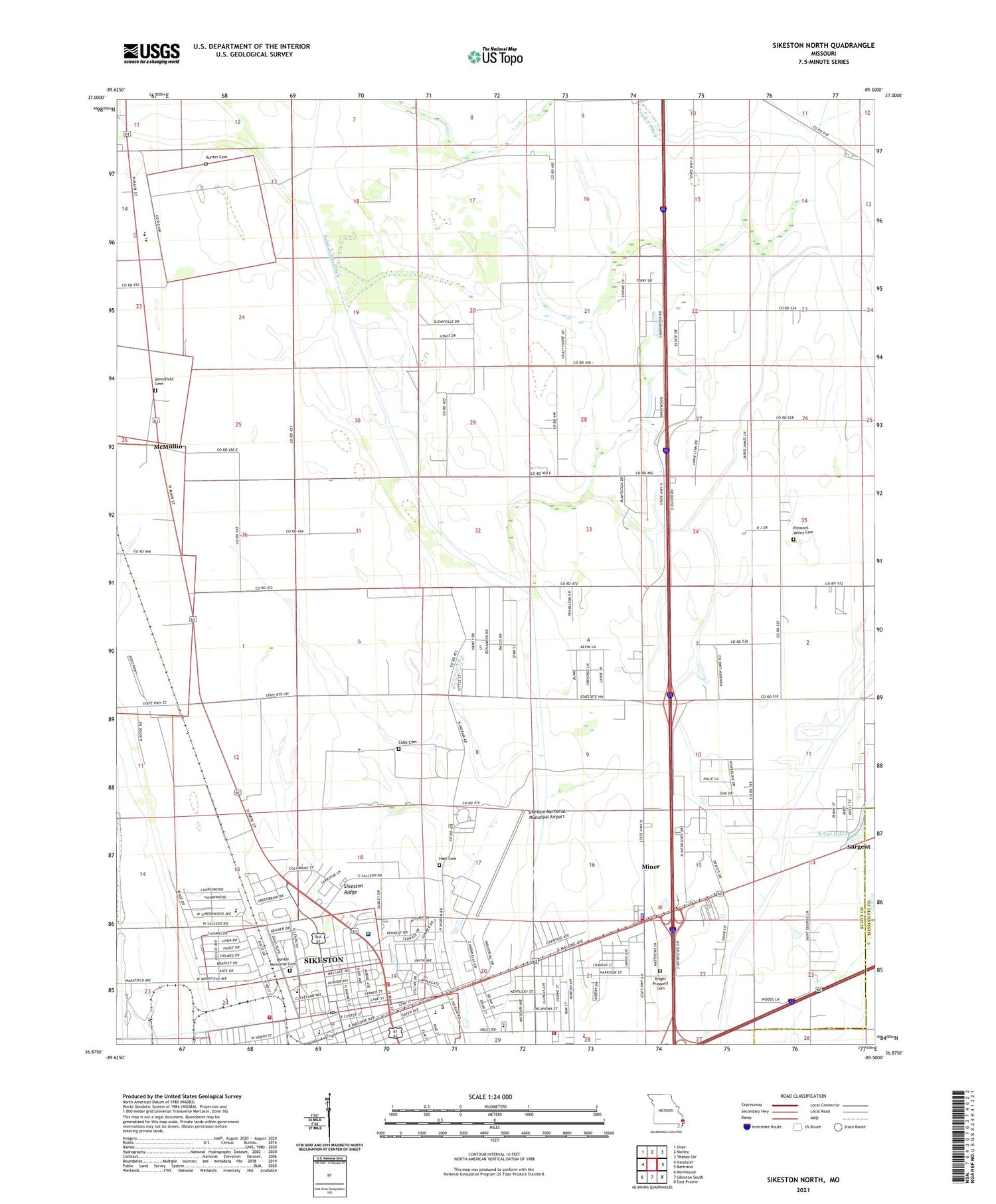
2021 topographic map quadrangle Sikeston North in the state of Missouri. Scale: 1:24000. Based on the newly updated USGS 7.5' US Topo map series, this map is in the following counties: Scott, Mississippi. The map contains contour data, water features, and other items you are used to seeing on USGS maps, but also has updated roads and other features. This is the next generation of topographic maps. Printed on high-quality waterproof paper with UV fade-resistant inks.
Quads adjacent to this one:
West: Vanduser
Northwest: Oran
North: Morley
Northeast: Thebes SW
East: Bertrand
Southeast: East Prairie
South: Sikeston South
Southwest: Morehouse
Contains the following named places: Airport School, Bennifield Cemetery, Blodgett School, Boardman School, Bright Prospect Church, Chaney School, City of Miner, City of Sikeston, Cobb Cemetery, Dunver School, Hart Cemetery, Hunter Cemetery, Hunter School, Lennox School, Malone Park, Matthews School, McMullin, Melon, Miner, Miner Fire Station, Miner Police Department, Miner School, Missouri Delta Heliport, Missouri Delta Medical Center, Northside Church, Pleasant Valley Cemetery, Pleasant Valley Church, Saint Francis School, Saint Francis Xavier Church, Sand Prairie School, Sargent, Shady Grove School, Sikeston, Sikeston Department of Public Safety Fire Division Station 2, Sikeston Department of Public Safety Fire Division Station 3, Sikeston Memorial Municipal Airport, Sikeston Police Department, Sikeston Post Office, Sikeston Public Safety Fire Division Station 1, Sikeston Ridge, Silent Hill Church, Town Ditch, Township of Richland, Township of Sandywoods, ZIP Code: 63801


