MyTopo
Sikeston South Missouri US Topo Map
Couldn't load pickup availability
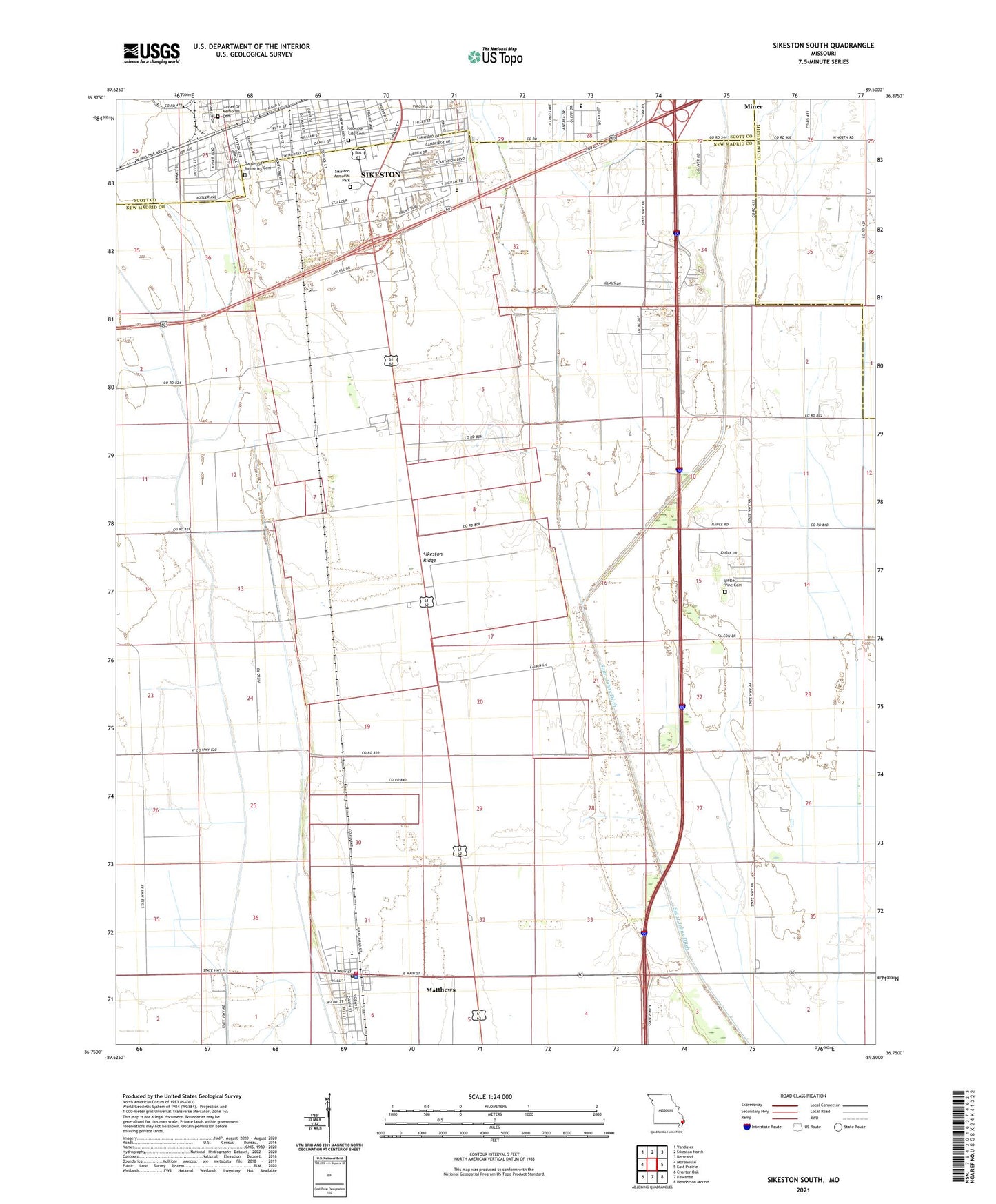
2021 topographic map quadrangle Sikeston South in the state of Missouri. Scale: 1:24000. Based on the newly updated USGS 7.5' US Topo map series, this map is in the following counties: New Madrid, Scott, Mississippi. The map contains contour data, water features, and other items you are used to seeing on USGS maps, but also has updated roads and other features. This is the next generation of topographic maps. Printed on high-quality waterproof paper with UV fade-resistant inks.
Quads adjacent to this one:
West: Morehouse
Northwest: Vanduser
North: Sikeston North
Northeast: Bertrand
East: East Prairie
Southeast: Henderson Mound
South: Kewanee
Southwest: Charter Oak
Contains the following named places: Bowman, Bowman School, Champion, City of Matthews, Clayton Park, Conay School, East Lake, Fairview School, Garden of Memories Cemetery, Juanita, Kingsway Mall, KMPL-AM (Sikeston), KSIM-AM (Sikeston), KSTG-FM (Sikeston), Lincoln School, Little Vine Church, Matthews, Matthews Police Department, Matthews Post Office, Matthews Volunteer Fire Department, Pharris Ridge School, Saint Johns Ditch, Sikeston City Cemetery, Sikeston Memorial Park, South School, Township of Big Prairie, West End Park, Wilber School, York School