MyTopo
Skidmore NW Missouri US Topo Map
Couldn't load pickup availability
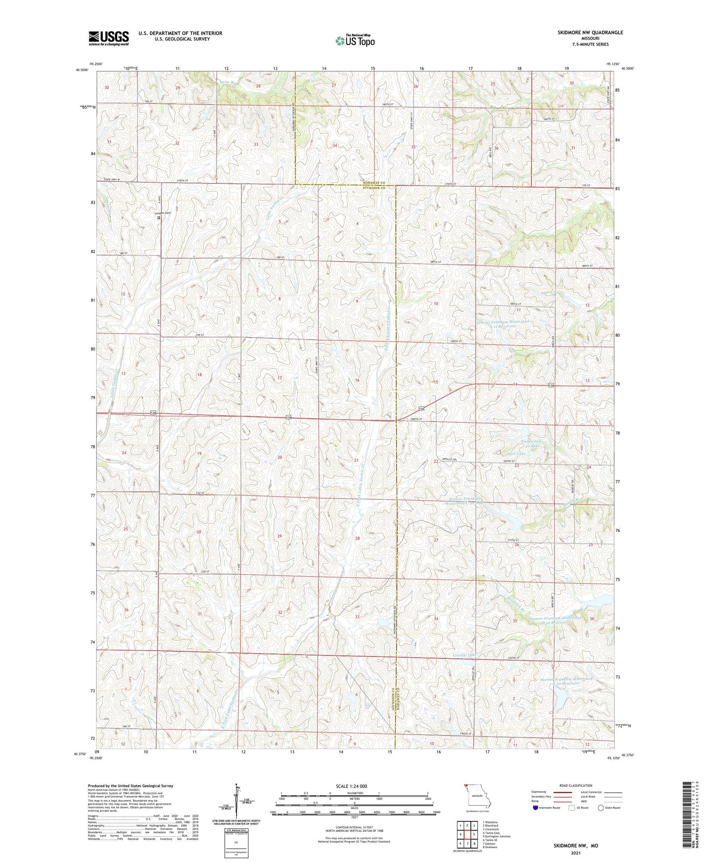
2021 topographic map quadrangle Skidmore NW in the state of Missouri. Scale: 1:24000. Based on the newly updated USGS 7.5' US Topo map series, this map is in the following counties: Nodaway, Atchison. The map contains contour data, water features, and other items you are used to seeing on USGS maps, but also has updated roads and other features. This is the next generation of topographic maps. Printed on high-quality waterproof paper with UV fade-resistant inks.
Quads adjacent to this one:
West: Tarkio East
Northwest: Westboro
North: Blanchard
Northeast: Clearmont
East: Burlington Junction
Southeast: Skidmore
South: Dotham
Southwest: Tarkio SE
Contains the following named places: Butler School, Derr Lake, Derr Lake Dam, Eudora School, Happy Hill School, Hoover Frankum Watershed A-11 Dam, Hoover Frankum Watershed A-11 Reservoir, Hoover Frankum Watershed A-23 Dam, Hoover Frankum Watershed D 12 Reservoir, Hoover Frankum Watershed E 20 Dam, Hoover Frankum Watershed E 20 Reservoir, Hoover Frankum Watershed Number, Hoover Frankum Watershed Structure C-20 Dam, Hoover Frankum Watershed Structure D-12 Dam, Hoover-Frankum Watershed C-22 Dam, Hoover-Frankum Watershed C-22 Lake, Linville Lake, London, London Cemetery, London Post Office, Lone Star School, Lorain School, Mononame 25 Dam, Nodaway C-20 Lake, North Star School, Salem School, Township of Colfax