MyTopo
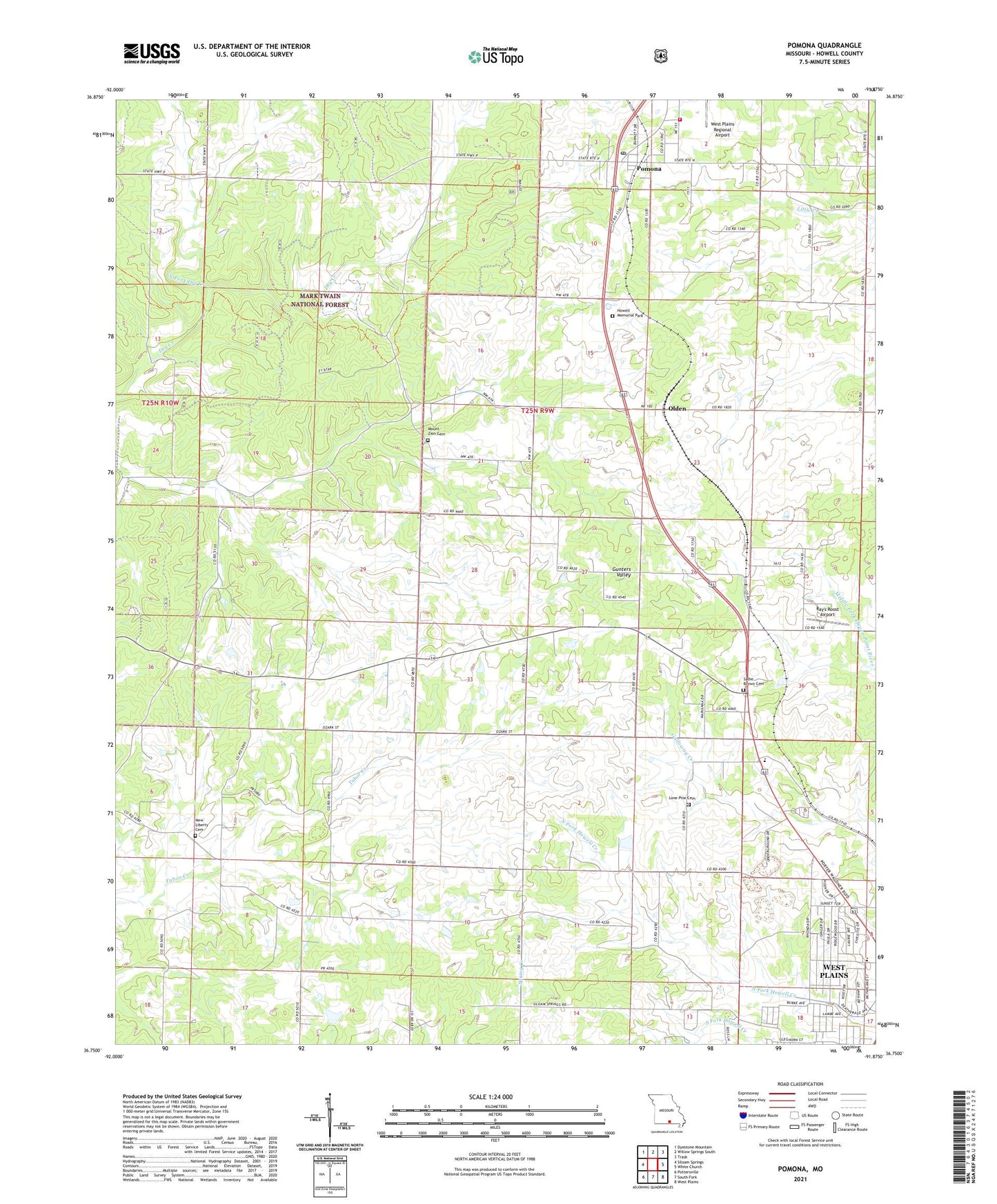
Pomona Missouri US Topo Map
Couldn't load pickup availability
Also explore the Pomona Forest Service Topo of this same quad for updated USFS data
2021 topographic map quadrangle Pomona in the state of Missouri. Scale: 1:24000. Based on the newly updated USGS 7.5' US Topo map series, this map is in the following counties: Howell. The map contains contour data, water features, and other items you are used to seeing on USGS maps, but also has updated roads and other features. This is the next generation of topographic maps. Printed on high-quality waterproof paper with UV fade-resistant inks.
Quads adjacent to this one:
West: Siloam Springs
Northwest: Dyestone Mountain
North: Willow Springs South
Northeast: Trask
East: White Church
Southeast: West Plains
South: South Fork
Southwest: Pottersville
This map covers the same area as the classic USGS quad with code o36091g8.
Contains the following named places: Bridges School, Cozy Grove Hotel, Friendship Church, Grimmet Church, Grimmet School, Henderson and Day Dam, Howell County, Lone Pine Cemetery, Lone Pine School, Mount Zion Church, New Central School, New Liberty Cemetery, New Liberty Church, North Fork Dry Creek, Olden, Pomona, Pomona Census Designated Place, Pomona Fire Protection District, Pomona Post Office, Ray's Roost Airport, Richards R-5 School, Rudville School, Sky Haven Airport, Township of Dry Creek