MyTopo
Caulfield Missouri US Topo Map
Couldn't load pickup availability
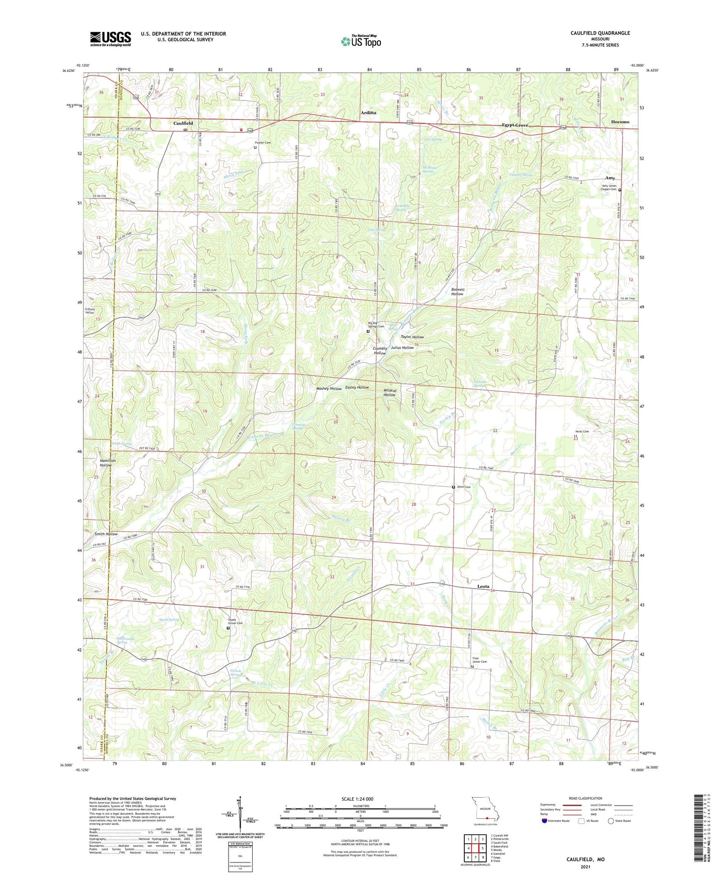
2021 topographic map quadrangle Caulfield in the state of Missouri. Scale: 1:24000. Based on the newly updated USGS 7.5' US Topo map series, this map is in the following counties: Howell, Ozark. The map contains contour data, water features, and other items you are used to seeing on USGS maps, but also has updated roads and other features. This is the next generation of topographic maps. Printed on high-quality waterproof paper with UV fade-resistant inks.
Quads adjacent to this one:
West: Bakersfield
Northwest: Cureall NW
North: Pottersville
Northeast: South Fork
East: Moody
Southeast: Viola
South: Gepp
Southwest: Gamaliel
This map covers the same area as the classic USGS quad with code o36092e1.
Contains the following named places: Alice Mine, Amy, Arditta, Big Spring, Big Spring Church, Big Spring School, Bly, Bly Big Springs Cemetery, Bly Post Office, Boswell Hollow, Campbell Ranch Airport, Caulfield, Caulfield Fire Department, Caulfield Post Office, Corn Creek, Crumbly Hollow, Crumbly Spring, Easley Branch, Easley Hollow, Egypt Grove, Egypt Grove Church, Egypt School, Elm Pond, Fair Spring, Fite Spring, Fowler Cemetery, Fowler Church, Free Union Church, Free Union School, Halsey Branch, Hamilton Hollow, Hocomo, Horn Creek, Joice Cemetery, Julius Hollow, Lair Lake, Lair Lake Dam, Leota, Limekiln Spring, Mashey Hollow, McDaniel Spring, Mirey Fork, Nicholas Spring, Nichols Spring, Nicks Cemetery, Oak Grove School, Oak Mound School, Prairie Grove Church, Prairie Grove School, Rattlesnake Spring, Ray Branch, Shady Grove Church, Shady Grove School, Smith Hollow, Smith Spring, Spark Spring, Stony Point School, Taylor Hollow, Township of Benton, Union Chapel, Vaughn Spring, Wetherhill, Wildcat Hollow