MyTopo
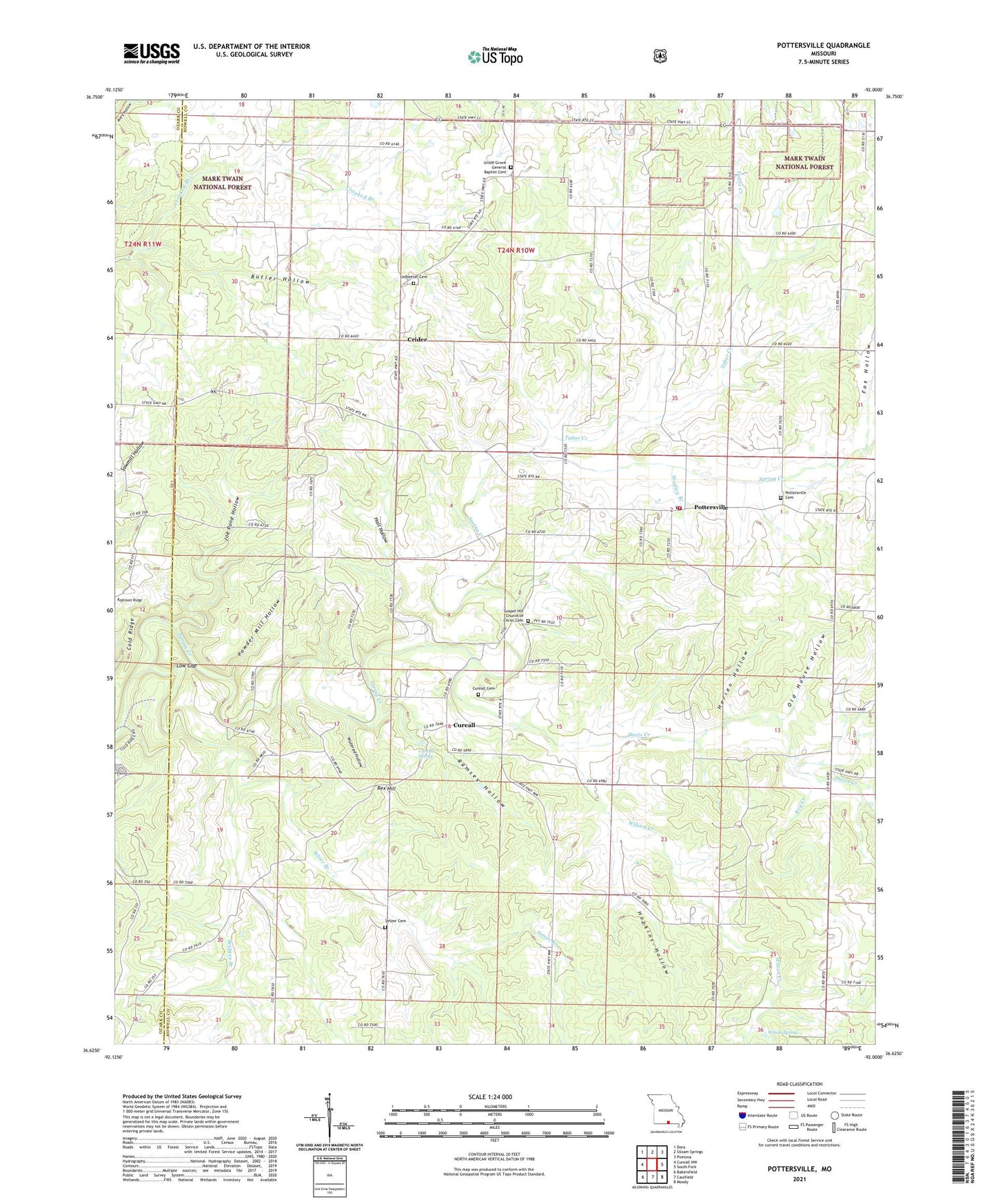
Pottersville Missouri US Topo Map
Couldn't load pickup availability
Also explore the Pottersville Forest Service Topo of this same quad for updated USFS data
2021 topographic map quadrangle Pottersville in the state of Missouri. Scale: 1:24000. Based on the newly updated USGS 7.5' US Topo map series, this map is in the following counties: Howell, Ozark. The map contains contour data, water features, and other items you are used to seeing on USGS maps, but also has updated roads and other features. This is the next generation of topographic maps. Printed on high-quality waterproof paper with UV fade-resistant inks.
Quads adjacent to this one:
West: Cureall NW
Northwest: Dora
North: Siloam Springs
Northeast: Pomona
East: South Fork
Southeast: Moody
South: Caulfield
Southwest: Bakersfield
This map covers the same area as the classic USGS quad with code o36092f1.
Contains the following named places: Bridges Branch, Butler Hollow, Cold Ridge, Crider, Crider School, Crossroads Church, Cureall, Cureall Cemetery, Cureall Church, Cureall School, Cureall Spring, Davis Creek, Davis Creek Church, Fox Hollow, Gospel Hill Church, Hall Hollow, Herien Hollow, Hide A Way Lake, Hide A Way Lake Dam, Hopkins Hollow, Joe Pond Hollow, Key Creek, Ledbetter Cemetery, Little Zion Church, Low Gap, Morning Glory Zinc Mine, Old House Hollow, Pleasant Point School, Pottersville, Pottersville Cemetery, Pottersville Post Office, Pottersville School, Pottersville Volunteer Fire Department, Powder Mill Hollow, Ramsey Hollow, Rex Hill, Rex Mines, Seedtick Church, Setzer Branch, Setzer Cemetery, Tabor Creek, Township of Spring Creek, Union Grove General Baptist Cemetery, Union Grove General Baptist Church, Vienna School, Wadley Branch, Watered Hollow, Willow Creek, Wilson Creek, Wilson Spring, ZIP Code: 65790