MyTopo
Anderson Missouri US Topo Map
Couldn't load pickup availability
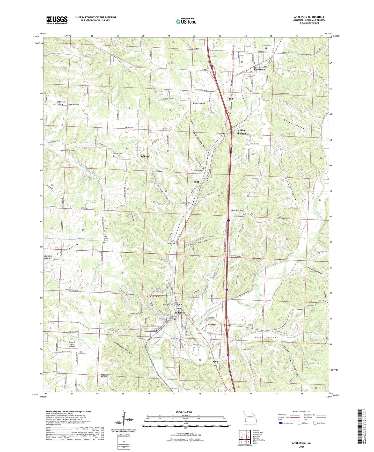
2021 topographic map quadrangle Anderson in the state of Missouri. Scale: 1:24000. Based on the newly updated USGS 7.5' US Topo map series, this map is in the following counties: McDonald. The map contains contour data, water features, and other items you are used to seeing on USGS maps, but also has updated roads and other features. This is the next generation of topographic maps. Printed on high-quality waterproof paper with UV fade-resistant inks.
Quads adjacent to this one:
West: Tiff City
Northwest: Seneca
North: Neosho West
Northeast: Neosho East
East: McNatt
Southeast: Jane
South: Noel
Southwest: South West City
This map covers the same area as the classic USGS quad with code o36094f4.
Contains the following named places: Allison Hollow, Anderson, Anderson Elementary School, Anderson Middle School, Anderson Post Office, Anderson School, Anderson Volunteer Fire Department, B and S Farms Airfield, Banner School, Beaver Branch, Bunkum Hollow, Chamberlain Hollow, City of Anderson, City of Goodman, Eagle School, East Hollow, Elliff, Erie School, Goodman, Goodman Area Fire Protection District, Goodman Elementary School, Goodman Police Department, Goodman Post Office, Holloway Mountain, Huffaker Hollow, Kelley Springs, McDonald County High School, Moss School, Mount Zion Church, Mud Springs Hollow, New Bethel School, North Fork Beeman Branch, Ozark Church, Pole Cat Hollow, Rocky Hollow, Sellers Hollow, South Fork Beeman Branch, Splitlog, Splitlog Hollow, Tatum Hill, Thief Hollow, Town Hollow, Township of Anderson East, Township of Anderson West, Township of Erie Goodman, Twin Springs Hollow, Walnut Hollow, ZIP Codes: 64831, 64843