MyTopo
Sprott Missouri US Topo Map
Couldn't load pickup availability
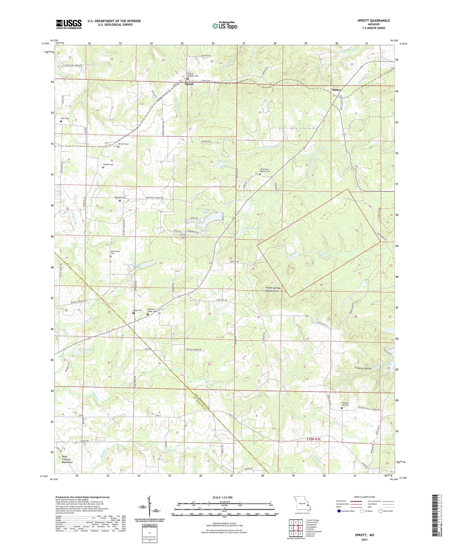
2021 topographic map quadrangle Sprott in the state of Missouri. Scale: 1:24000. Based on the newly updated USGS 7.5' US Topo map series, this map is in the following counties: Ste. Genevieve, St. Francois. The map contains contour data, water features, and other items you are used to seeing on USGS maps, but also has updated roads and other features. This is the next generation of topographic maps. Printed on high-quality waterproof paper with UV fade-resistant inks.
Quads adjacent to this one:
West: Farmington
Northwest: French Village
North: Lawrenceton
Northeast: Weingarten
East: Coffman
Southeast: Womack
South: Knob Lick
Southwest: Wachita Mountain
Contains the following named places: Burks School, Busiek School, Camp Creek, Chestnut Ridge, Chestnut Ridge Baptist Church, Chestnut Ridge Cemetery, Chestnut Ridge School, Doss Cemetery, Genevieve Church, Hart Lake, Henry Hollow, Hintze Lake Dam, Jonca, Jonca School, Kaeppel Lake Dam, Kimmel Lake, Kimmel Lake Dam, Lake Genevieve, Lake Genevieve Lower Dam, Madison School, Mc Gee Cemetery, McClintock Cemetery, Millers, Monahan Lake, Mononame 212 Dam, Mononame 613 Dam, Moynihan Lake Dam, Murphy Cemetery, North Fork Jonca Creek, Oakland Cemetery, Pickel, Pickle Springs Double Arch, Pineview Dam, Pineview Lake, Pleasant Hill Cemetery, Pleasant Hill Church, Ponca Post Office, Rudy Cemetery, Sainte Genevieve Sportsman Club Lake Dam, Sand Creek, Schaefer Lake Dam, South Fork Jonca Creek, Spring Hart Lake Dam, Sprott, Taylor Branch, Tragden Lake, Trautman Lake, Trautman Lake Dam, Unity School, Valley Forge, Valley Forge School