MyTopo
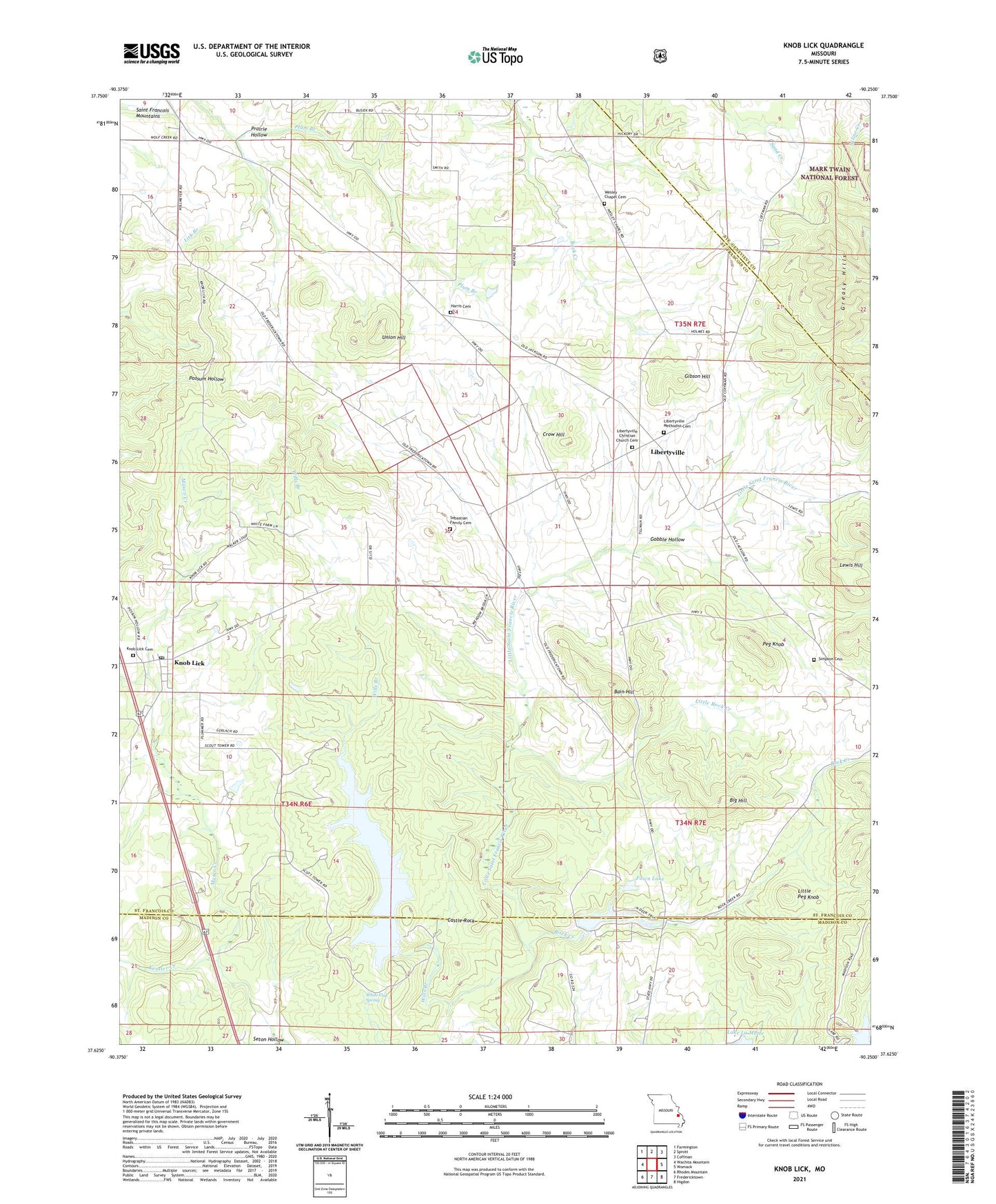
Knob Lick Missouri US Topo Map
Couldn't load pickup availability
2021 topographic map quadrangle Knob Lick in the state of Missouri. Scale: 1:24000. Based on the newly updated USGS 7.5' US Topo map series, this map is in the following counties: St. Francois, Madison, Ste. Genevieve. The map contains contour data, water features, and other items you are used to seeing on USGS maps, but also has updated roads and other features. This is the next generation of topographic maps. Printed on high-quality waterproof paper with UV fade-resistant inks.
Quads adjacent to this one:
West: Wachita Mountain
Northwest: Farmington
North: Sprott
Northeast: Coffman
East: Womack
Southeast: Higdon
South: Fredericktown
Southwest: Rhodes Mountain
This map covers the same area as the classic USGS quad with code o37090f3.
Contains the following named places: Bain Hill, Big Hill, Castle Rock, Cherokee Trail Roadside Park, Clearview School, Crossroads Church, Crow Hill, Deer Run Lake, Deer Run Lake Dam, Eugene D Nims Lake, Fairview School, Fawn Lake, Fawn Lake Dam, Gibson Hill, Gobble Hollow, Greasy Hills, Harris Cemetery, Independence School, Kessler Creek, Knob Lick, Knob Lick Cemetery, Knob Lick Census Designated Place, Knob Lick Post Office, Lewis Hill, Libertyville, Libertyville Christian Church, Libertyville Methodist Cemetery, Little Peg Knob, Little Rock Creek, Lost Valley Lake Dam, Mine la Motte Dam, Nims Lake, Nims Lake Dam, Peg Knob, Plum Branch, Prairie Hollow, Rock Creek, Rock Creek School, Sebastian Family Cemetery, Seton Hollow, S-F Scout Ranch, Simpson Cemetery, Texas Baptist Church, Township of Liberty, Union Hill, Wesley Chapel, Wesley Chapel Cemetery, White Oak Spring, Wills Branch