MyTopo
Neosho West Missouri US Topo Map
Couldn't load pickup availability
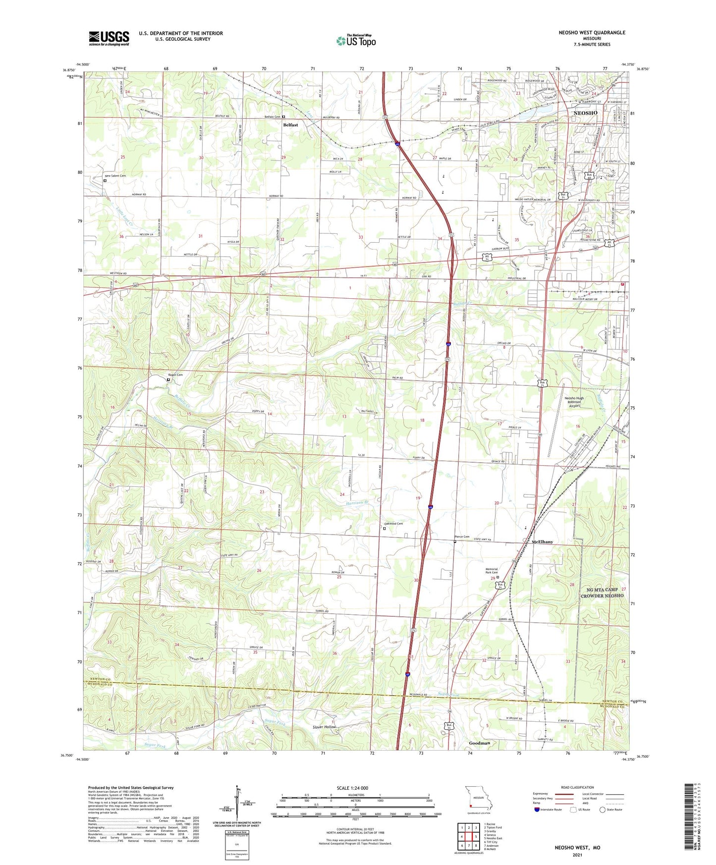
2021 topographic map quadrangle Neosho West in the state of Missouri. Scale: 1:24000. Based on the newly updated USGS 7.5' US Topo map series, this map is in the following counties: Newton, McDonald. The map contains contour data, water features, and other items you are used to seeing on USGS maps, but also has updated roads and other features. This is the next generation of topographic maps. Printed on high-quality waterproof paper with UV fade-resistant inks.
Quads adjacent to this one:
West: Seneca
Northwest: Racine
North: Tipton Ford
Northeast: Granby
East: Neosho East
Southeast: McNatt
South: Anderson
Southwest: Tiff City
This map covers the same area as the classic USGS quad with code o36094g4.
Contains the following named places: Art, Belfast, Belfast Church, Belfast School, Burch Church, Burch School, Church of God, Fontella, George Washington Carver Elementary School, Goodman Lookout Tower, Harmony Shopping Center, Harrison Branch, Jay Bird School, KNEO-FM (Neosho), McElhany, Meeks School, Missouri Department of Conservation Forestry Southwest Regional Field Fire Office Neosho, Neosho Fire Department Station 2, Neosho High School, Neosho Hugh Robinson Airport, Neosho Junior High School, Neosho Memorial Park, Neosho Middle School, New Salem Cemetery, New Salem Church, Niles Station, Norwood School, Oakwood Church, Pools Prairie, Ragan Cemetery, Regan School, School Number 126, Slover Hollow, South Elementary School, Township of West Benton, Wall, West Benton School, ZIP Code: 64850