MyTopo
Tunas Missouri US Topo Map
Couldn't load pickup availability
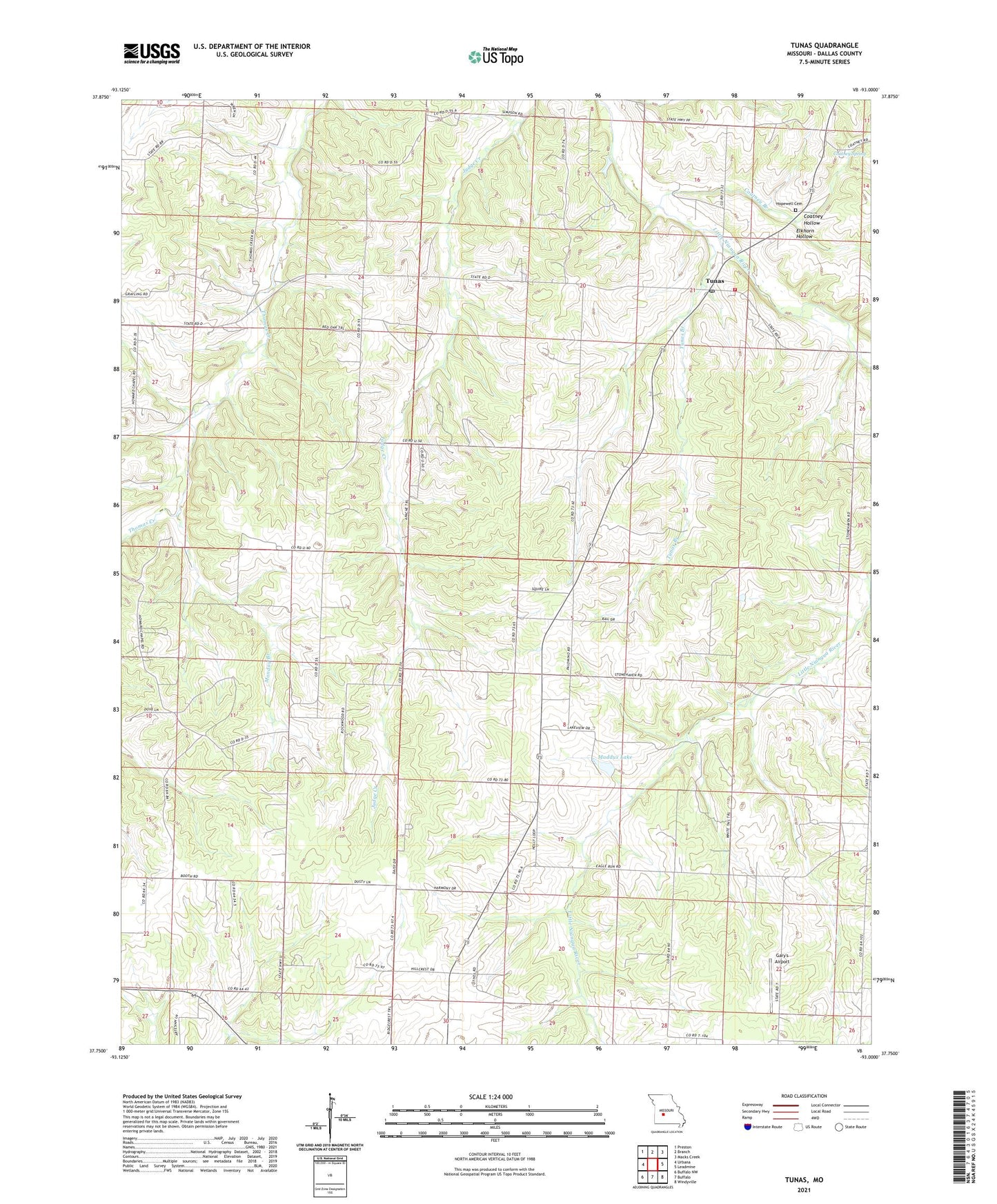
2021 topographic map quadrangle Tunas in the state of Missouri. Scale: 1:24000. Based on the newly updated USGS 7.5' US Topo map series, this map is in the following counties: Dallas. The map contains contour data, water features, and other items you are used to seeing on USGS maps, but also has updated roads and other features. This is the next generation of topographic maps. Printed on high-quality waterproof paper with UV fade-resistant inks.
Quads adjacent to this one:
West: Urbana
Northwest: Preston
North: Branch
Northeast: Macks Creek
East: Leadmine
Southeast: Windyville
South: Buffalo
Southwest: Buffalo NW
Contains the following named places: Booth School, Cherry Grove Church, Coatney Branch, Coatney Hollow, Coatney Spring, Elkhorn Hollow, Gary's Airport, Hopewell Cemetery, Hopewell Church, Howard Chapel, Hyde School, Maddux Lake, Maddux Lake Dam, Monday Branch, Township of Grant, Township of Sherman, Tunas, Tunas Branch, Tunas Post Office, Tunas School, Tunas Volunteer Fire Department, Willow Spring School