MyTopo
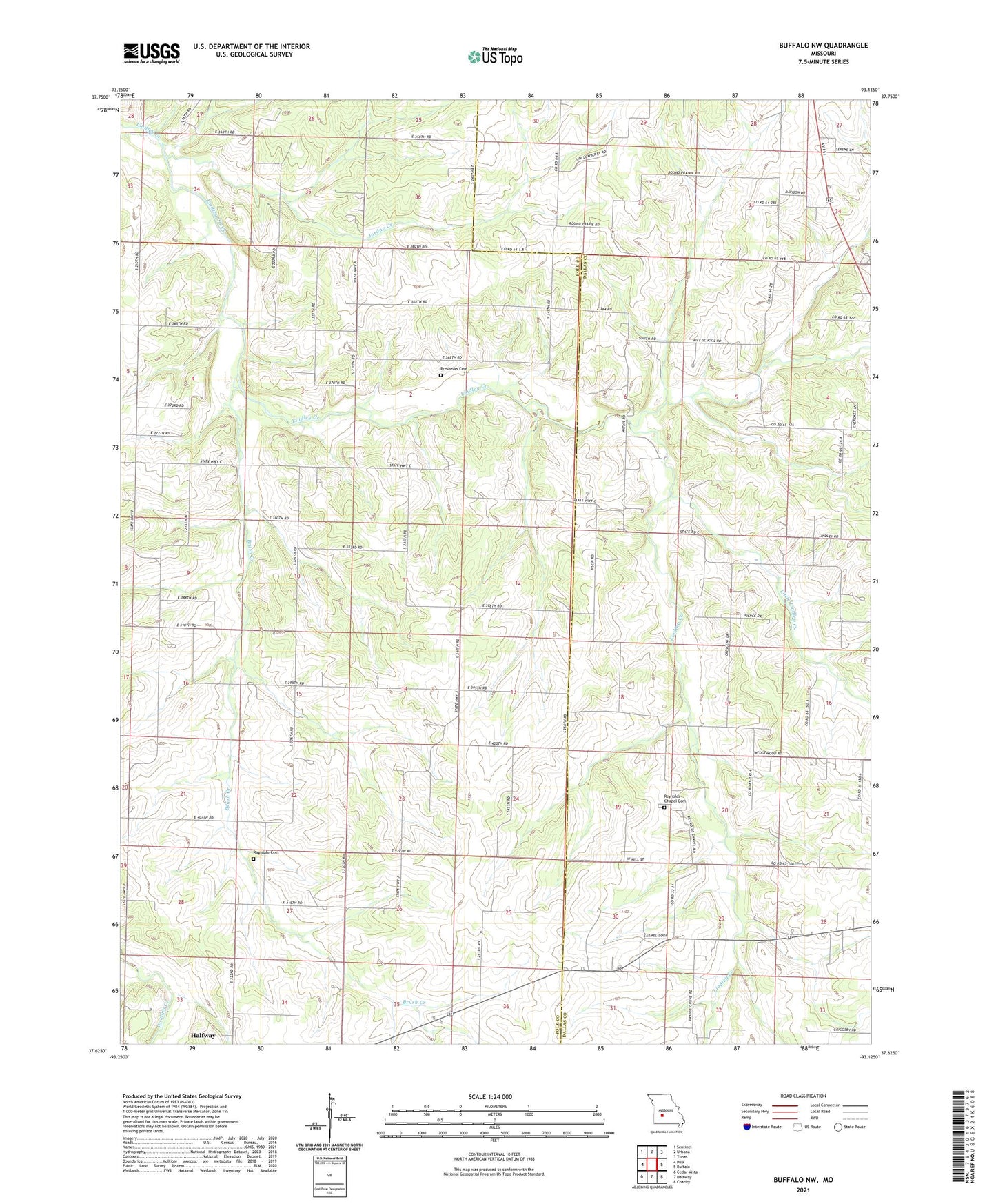
Buffalo NW Missouri US Topo Map
Couldn't load pickup availability
2021 topographic map quadrangle Buffalo NW in the state of Missouri. Scale: 1:24000. Based on the newly updated USGS 7.5' US Topo map series, this map is in the following counties: Polk, Dallas. The map contains contour data, water features, and other items you are used to seeing on USGS maps, but also has updated roads and other features. This is the next generation of topographic maps. Printed on high-quality waterproof paper with UV fade-resistant inks.
Quads adjacent to this one:
West: Polk
Northwest: Sentinel
North: Urbana
Northeast: Tunas
East: Buffalo
Southeast: Charity
South: Halfway
Southwest: Cedar Vista
This map covers the same area as the classic USGS quad with code o37093f2.
Contains the following named places: Breshears Cemetery, Brooks School, Brush Creek, Brush Creek School, Carter School, Clifford, Concord School, Coy School, Crescent School, Independence School, Jensen Lake Dam, Jordan Creek, Lindley Church, Little Lindley Creek, Mathis, Mission, Ragsdale Cemetery, Reynolds, Reynolds Chapel, Reynolds Chapel Cemetery, Reynolds School, Sergent Lake Dam, Township of South Green