MyTopo
Verona Missouri US Topo Map
Couldn't load pickup availability
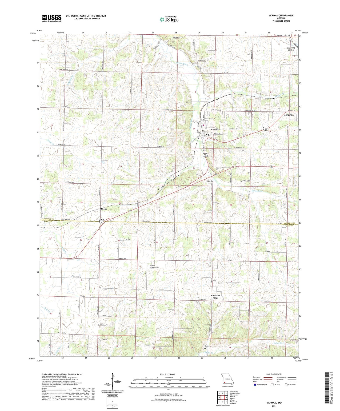
2021 topographic map quadrangle Verona in the state of Missouri. Scale: 1:24000. Based on the newly updated USGS 7.5' US Topo map series, this map is in the following counties: Lawrence, Barry. The map contains contour data, water features, and other items you are used to seeing on USGS maps, but also has updated roads and other features. This is the next generation of topographic maps. Printed on high-quality waterproof paper with UV fade-resistant inks.
Quads adjacent to this one:
West: Monett
Northwest: Stotts City
North: Mount Vernon
Northeast: Chesapeake
East: Aurora
Southeast: Jenkins
South: McDowell
Southwest: Purdy
Contains the following named places: Browning Hollow, Calton Cemetery, Chat Creek, Crescent School, Douger Branch, Globe, Kings Prairie School, Line School, Monett Rural Fire Association Station 2, New Liberty Church, Pleasant Ridge, Pleasant Ridge Census Designated Place, Pleasant Ridge School, Spring River Cemetery, Town of Verona, Township of Kings Prairie, Township of Pleasant Ridge, Township of Spring River, Verona, Verona Elementary School, Verona High School, Verona Police Department, Verona Post Office, Verona Volunteer Fire Department, Wade School, Wheeler School, Wilkes School, Wolf School, ZIP Code: 65769