MyTopo
Coin Iowa US Topo Map
Couldn't load pickup availability
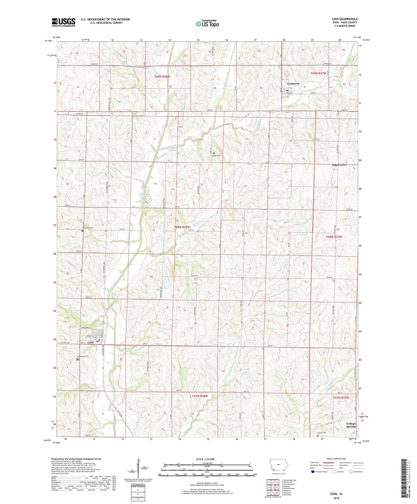
2022 topographic map quadrangle Coin in the state of Iowa. Scale: 1:24000. Based on the newly updated USGS 7.5' US Topo map series, this map is in the following counties: Page. The map contains contour data, water features, and other items you are used to seeing on USGS maps, but also has updated roads and other features. This is the next generation of topographic maps. Printed on high-quality waterproof paper with UV fade-resistant inks.
Quads adjacent to this one:
West: Bingham
Northwest: Shenandoah East
North: Stanton SW
Northeast: Clarinda North
East: Clarinda South
Southeast: Clearmont
South: Blanchard
Southwest: Westboro
This map covers the same area as the classic USGS quad with code o40095f2.
Contains the following named places: Buck Creek, City of Coin, City of Yorktown, Coin, Coin City Hall, Coin Library, Coin Post Office, Coin Volunteer Fire and Rescue, East Tarkio Creek, Elmwood Cemetery, Grove Cemetery, Page Center, Page County, Page Post Office, Pioneer County Park, Posley Cemetery, Saint Paul Lutheran Church, Snake Creek, Snow Hill, Snow Hill Cemetery, Tarkio City, Tarkio Post Office, Township of Lincoln, United Methodist Church, Yorktown, Yorktown Post Office, ZIP Codes: 51636, 51656