MyTopo
White Church Missouri US Topo Map
Couldn't load pickup availability
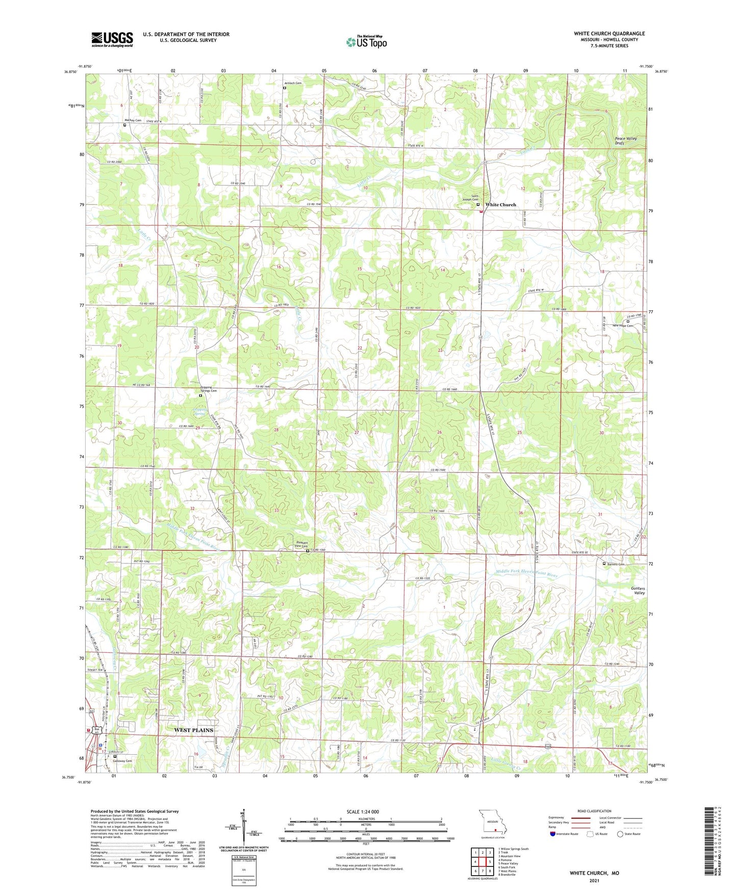
2021 topographic map quadrangle White Church in the state of Missouri. Scale: 1:24000. Based on the newly updated USGS 7.5' US Topo map series, this map is in the following counties: Howell. The map contains contour data, water features, and other items you are used to seeing on USGS maps, but also has updated roads and other features. This is the next generation of topographic maps. Printed on high-quality waterproof paper with UV fade-resistant inks.
Quads adjacent to this one:
West: Pomona
Northwest: Willow Springs South
North: Trask
Northeast: Mountain View
East: Peace Valley
Southeast: Brandsville
South: West Plains
Southwest: South Fork
Contains the following named places: Antioch Church, Barnett School, Brower School, Buck Park, Dripping Spring, Dripping Springs Cemetery, Dripping Springs Church, Galloway Creek, Galloway School, Highland School, Macke Church, New Hope Cemetery, New Hope Church, Oak Grove School, Peace Valley - White Church Volunteer Fire Department Station 1, Peace Valley Draft, Pleasant View Cemetery, Pleasant View Church, Pleasant View School, Potts School, Schneider School, Smith Chapel, Township of Sisson, West Plains Fire Department Station 1 - Headquarters, West Plains Police Department, White Church, White Church Church, White Church School, ZIP Code: 65789