MyTopo
Winnipeg Missouri US Topo Map
Couldn't load pickup availability
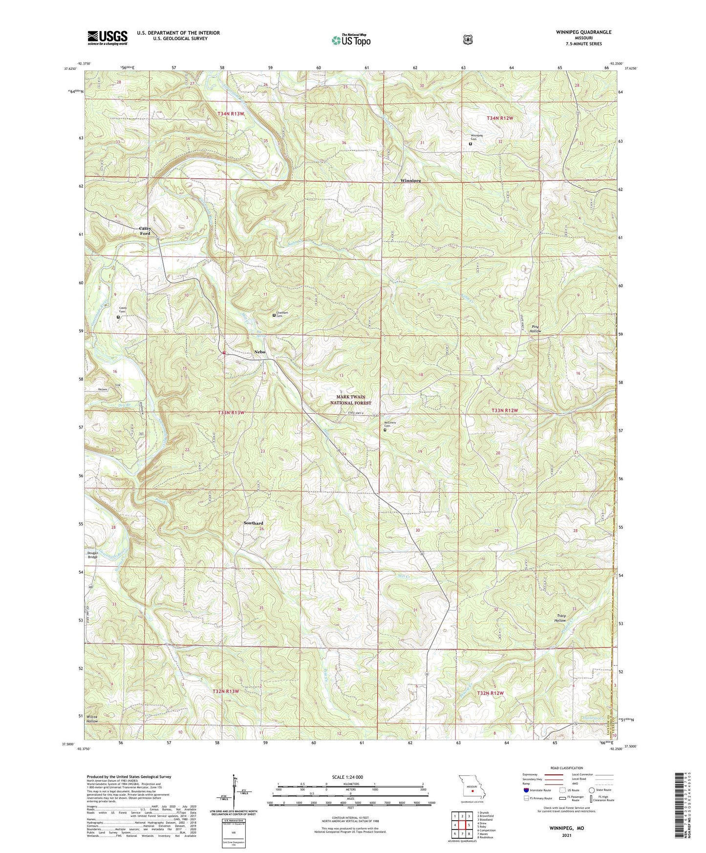
2021 topographic map quadrangle Winnipeg in the state of Missouri. Scale: 1:24000. Based on the newly updated USGS 7.5' US Topo map series, this map is in the following counties: Laclede, Texas. The map contains contour data, water features, and other items you are used to seeing on USGS maps, but also has updated roads and other features. This is the next generation of topographic maps. Printed on high-quality waterproof paper with UV fade-resistant inks.
Quads adjacent to this one:
West: Drew
Northwest: Drynob
North: Brownfield
Northeast: Bloodland
East: Roby
Southeast: Roubidoux
South: Manes
Southwest: Competition
Contains the following named places: Big Spring, Blackbird School, Casey - Dougan Cemetery, Casey Ford, Cedar Bluff Church, Central School, Chatham Cemetery, Dougan Bridge, Dry Branch, Fairview School, Kuhn Creek, McGinnis Cemetery, Mill Creek, Morehouse School, Mount Carney Church, Nebo, Nebo Falcon Rural Volunteer Fire Department Station 1, Nebo School, Norris Creek, Osage Gasconade Hills, Pine Creek, Pine Creek Church, Pine Creek Post Office, Pinecreek, Saint Annie, South Central Ozarks Planning Region, Southard, Success School, Township of Gasconade, Tracy Hollow, Winning Church, Winnipeg, Winnipeg Cemetery