MyTopo
Wyatt Missouri US Topo Map
Couldn't load pickup availability
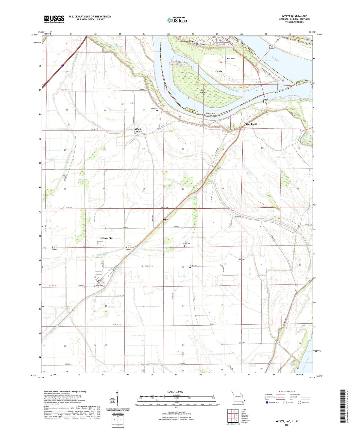
2021 topographic map quadrangle Wyatt in the states of Missouri, Illinois, Kentucky. Scale: 1:24000. Based on the newly updated USGS 7.5' US Topo map series, this map is in the following counties: Mississippi, Alexander, Ballard, Carlisle. The map contains contour data, water features, and other items you are used to seeing on USGS maps, but also has updated roads and other features. This is the next generation of topographic maps. Printed on high-quality waterproof paper with UV fade-resistant inks.
Quads adjacent to this one:
West: Charleston
Northwest: Cache
North: Cairo
Northeast: Barlow
East: Wickliffe
Southeast: Arlington
South: Wickliffe SW
Southwest: Anniston
Contains the following named places: Alfalfa Center, Allen Cemetery, Angelo Towhead, Bayou Ditch, Bird Cemetery, Bird Mill School, Birds Point, Birds Point School, Brewer Lake, Brewer Lake Ditch, Cairo Point, Church of the Redeemer, City of Wyatt, Deans Blue Hole, Dry Bayou, First Central Missionary Baptist Church, First Missionary Baptist Church, First United Methodist Church, Fort Defiance State Park, Greenfield, Greenfield Bend Revetment, Griggs Cemetery, Hoen Slough, Lateral Number 1, Little Rush Wood School, Minor Slough, Norfolk School District Number 6, Ohio River, Otter Pond, Rodney, Rush Ridge Cemetery, Rush Ridge Church, Rush Ridge School, Rushs Ridge, Saint Patricks Roman Catholic Church, Saint Patricks School, Saint Paul Baptist Church, Stevenson Bayou, Tom Bird Blue Hole, Township of Ohio, Village of Wilson City, Washington School, Wilson City, Wyatt, Wyatt Cemetery, Wyatt Post Office, Wyatt Volunteer Fire Department, ZIP Code: 63882