MyTopo
Belle Prairie Montana US Topo Map
Couldn't load pickup availability
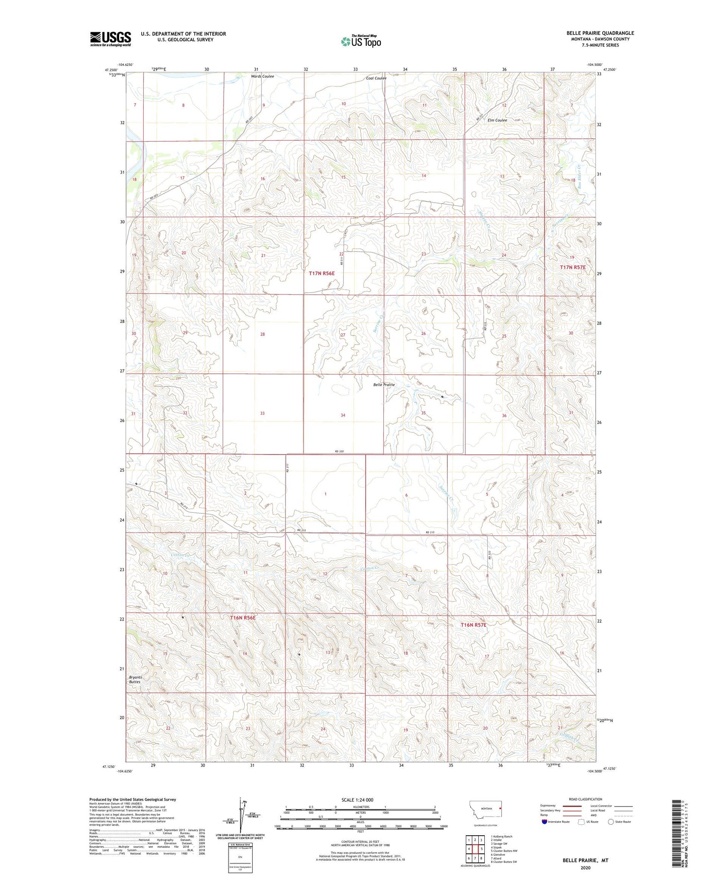
2024 topographic map quadrangle Belle Prairie in the state of Montana. Scale: 1:24000. Based on the newly updated USGS 7.5' US Topo map series, this map is in the following counties: Dawson. The map contains contour data, water features, and other items you are used to seeing on USGS maps, but also has updated roads and other features. This is the next generation of topographic maps. Printed on high-quality waterproof paper with UV fade-resistant inks.
Quads adjacent to this one:
West: Stipek
Northwest: Kolberg Ranch
North: Intake
Northeast: Savage SW
East: Cluster Buttes NW
Southeast: Cluster Buttes SW
South: Allard
Southwest: Glendive
This map covers the same area as the classic USGS quad with code o47104b5.
Contains the following named places: 16N56E02BDCB01 Well, 16N56E06AABC01 Well, 16N57E05CADA01 Well, 17N56E17BADD01 Well, 17N56E23DBCB01 Well, 17N56E27BDAA01 Well, Arthur Number 1 Dam, Belle Prairie, Belle Prairie School, Box Elder School, Coal Coulee, District Two School, Lower Belle Prairie School, Schoolhouse Coulee School, Serrine Creek, Shryve Creek, Wards Coulee