MyTopo
Lone Pine School Montana US Topo Map
Couldn't load pickup availability
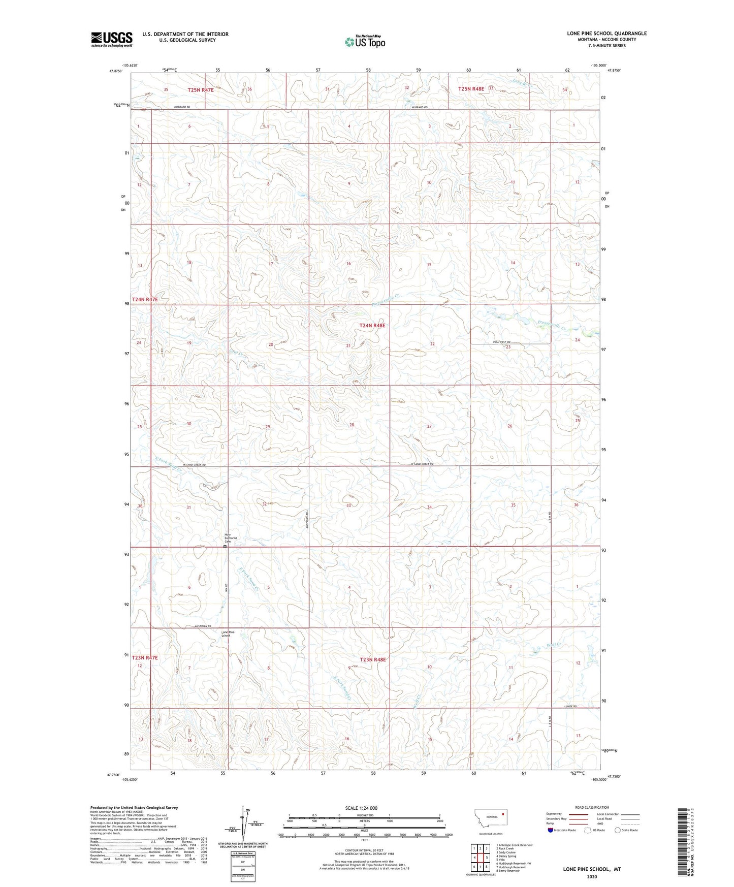
2024 topographic map quadrangle Lone Pine School in the state of Montana. Scale: 1:24000. Based on the newly updated USGS 7.5' US Topo map series, this map is in the following counties: McCone. The map contains contour data, water features, and other items you are used to seeing on USGS maps, but also has updated roads and other features. This is the next generation of topographic maps. Printed on high-quality waterproof paper with UV fade-resistant inks.
Quads adjacent to this one:
West: Dailey Spring
Northwest: Antelope Creek Reservoir
North: Rock Creek
Northeast: Gady Coulee
East: Vida
Southeast: Beery Reservoir
South: Hudiburgh Reservoir
Southwest: Hudiburgh Reservoir NW
This map covers the same area as the classic USGS quad with code o47105g5.
Contains the following named places: 16N49E07ADCA01 Well, 23N48E15AAAC01 Well, 24N48E17BBAB01 Well, 24N48E24BCBC01 Well, 25N48E34CCBA01 Well, Eugene S Number 1 Dam, Holy Eucharist Cemetery, Kwasney Dam, Lone Pine School