MyTopo
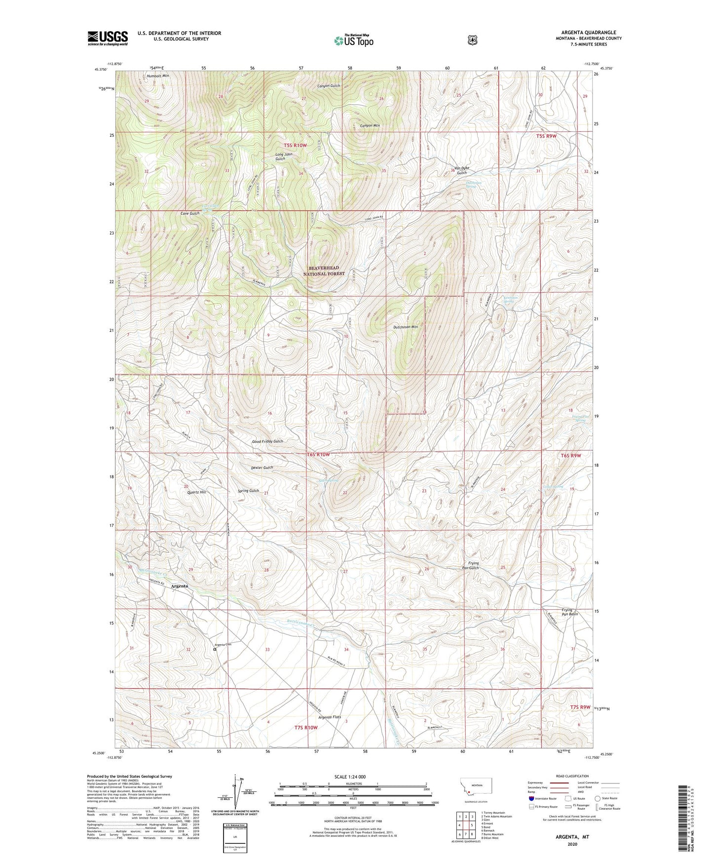
Argenta Montana US Topo Map
Couldn't load pickup availability
Also explore the Argenta Forest Service Topo of this same quad for updated USFS data
2024 topographic map quadrangle Argenta in the state of Montana. Scale: 1:24000. Based on the newly updated USGS 7.5' US Topo map series, this map is in the following counties: Beaverhead. The map contains contour data, water features, and other items you are used to seeing on USGS maps, but also has updated roads and other features. This is the next generation of topographic maps. Printed on high-quality waterproof paper with UV fade-resistant inks.
Quads adjacent to this one:
West: Ermont
Northwest: Torrey Mountain
North: Twin Adams Mountain
Northeast: Glen
East: Bond
Southeast: Dillon West
South: Burns Mountain
Southwest: Bannack
This map covers the same area as the classic USGS quad with code o45112c7.
Contains the following named places: 05S10W36DDCC01 Well, 06S10W29DDCD01 Well, Albers Spring, Albers Spring Mine, Amaranth/Robert Burns Mine, Anaconda Mine, Argenta, Argenta Cemetery, Argenta Census Designated Place, Argenta Flats, Argenta Post Office, Argenta School, Bell Ranch, Brownell Mine, Canyon Mountain, Capitol Mine, Cave Gulch Spring, Cedar Spring, Dexter Gulch, Dexter Gulch Mine, Dexter Mine, Dutchman Mountain, Dutchman Mountain Mine, Dutchman Spring, Fabac Ranch, Ferdinand Mine, Frying Pan Basin Mine, Frying Pan Spring, Galena Mine, Good Friday Gulch, Good Friday Gulch Mine, Govtilden Mine, Humbolt Mountain, Iron Mountain Mine, Jack Rabbit Mine, Kennison Spring, Long John Gulch, Long John Gulch Mine, Mauldin Mine, Meine Cow Camp, NW Section 29 Mine, Quartz Hill, Rosemont Mine, Site of Saligman Smelter, Spring Gulch, SW Section 8 Mine, Tuscarora Mine, Van Dyke Gulch, White Lime Mine