MyTopo
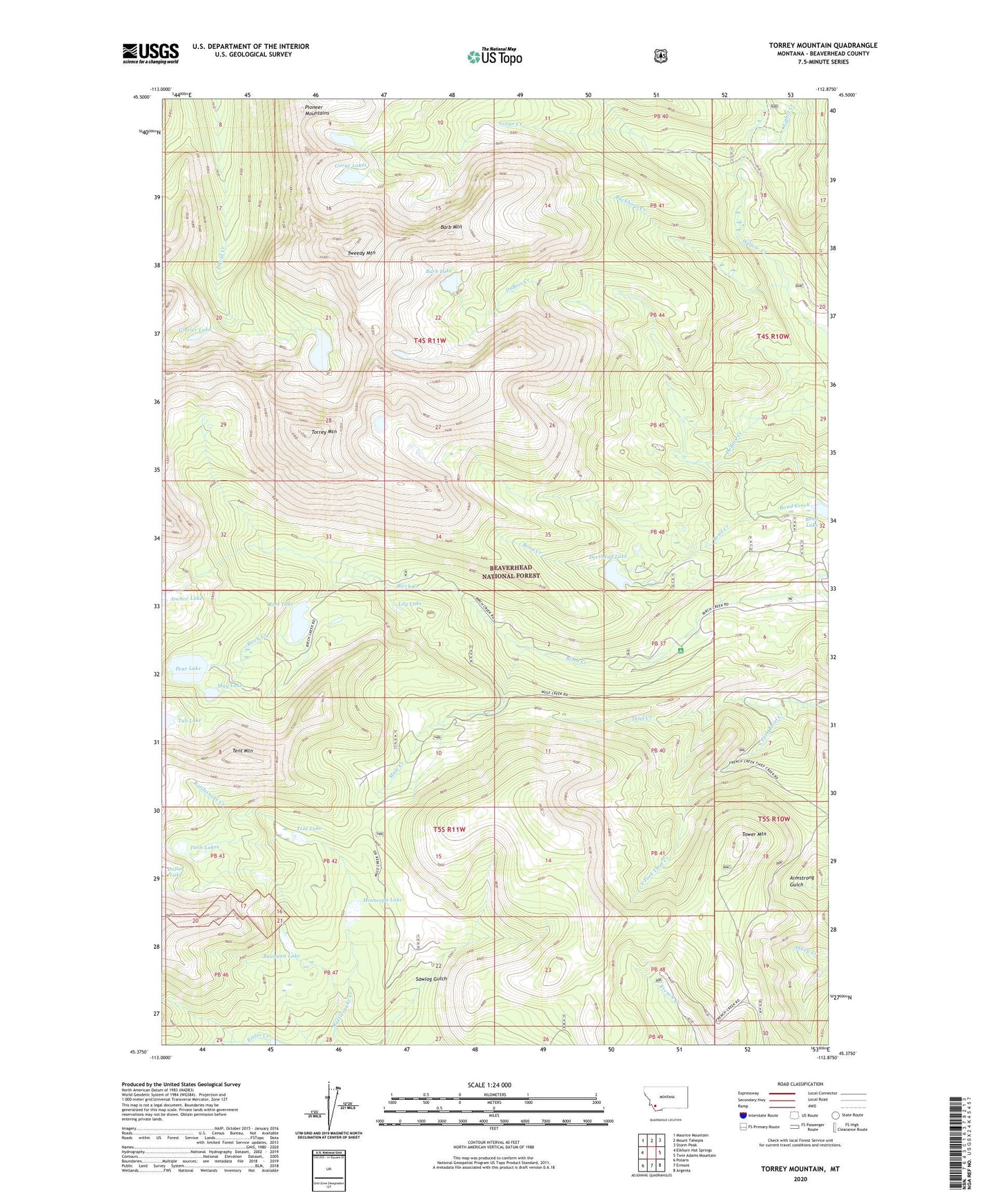
Torrey Mountain Montana US Topo Map
Couldn't load pickup availability
Also explore the Torrey Mountain Forest Service Topo of this same quad for updated USFS data
2024 topographic map quadrangle Torrey Mountain in the state of Montana. Scale: 1:24000. Based on the newly updated USGS 7.5' US Topo map series, this map is in the following counties: Beaverhead. The map contains contour data, water features, and other items you are used to seeing on USGS maps, but also has updated roads and other features. This is the next generation of topographic maps. Printed on high-quality waterproof paper with UV fade-resistant inks.
Quads adjacent to this one:
West: Elkhorn Hot Springs
Northwest: Maurice Mountain
North: Mount Tahepia
Northeast: Storm Peak
East: Twin Adams Mountain
Southeast: Argenta
South: Ermont
Southwest: Polaris
This map covers the same area as the classic USGS quad with code o45112d8.
Contains the following named places: Anchor Lake North Dam, Anchor South Dam, Barb Lake, Barb Mountain, Boatman Lake, Bond Lake, Boot Lake, Boot Lake Dam, Buckhorn Creek, Dearhead Lake Dam, Deerhead Lake, Dinner Station Campground, Estler Creek, Glacier Lake, Gorge Creek, Gorge Lakes, Humbolt Mountain Mine, Indian Squaw Mine, Lily Lake, Mast Ditch, May Lake, Minneopa Lake, Mule Creek, Pear Lake, Pear Lake Dam, Pioneer Mountains, South Fork Thief Creek, Tent Lake, Tent Mountain, Torrey Lake, Torrey Mountain, Tower Mountain, Tub Lake, Tub Lake Dam, Tweedy Mountain, Twin Lakes, Uphill Creek, US Treasurer Mine, Winkley Camp