MyTopo
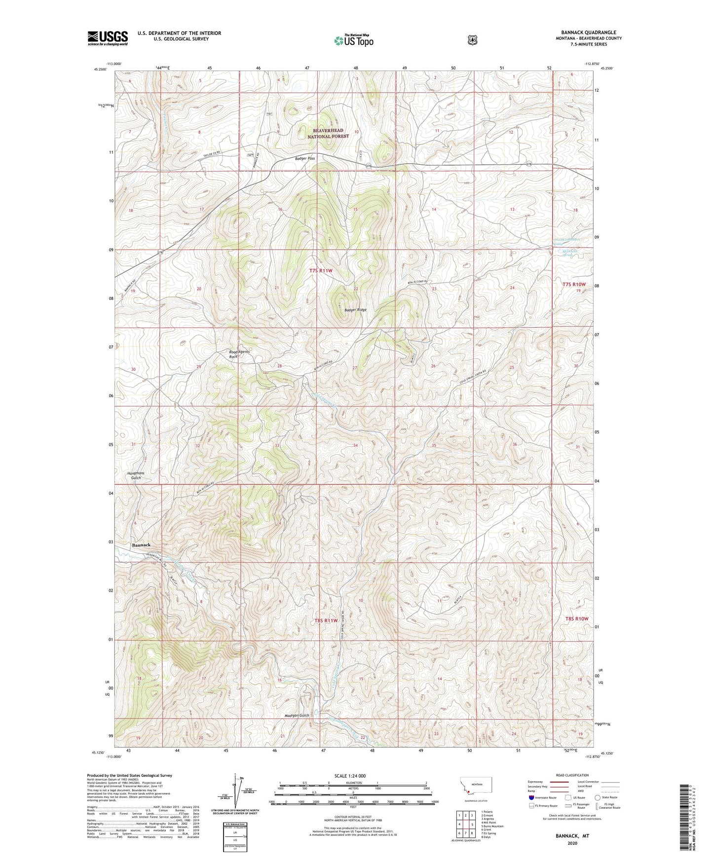
Bannack Montana US Topo Map
Couldn't load pickup availability
Also explore the Bannack Forest Service Topo of this same quad for updated USFS data
2024 topographic map quadrangle Bannack in the state of Montana. Scale: 1:24000. Based on the newly updated USGS 7.5' US Topo map series, this map is in the following counties: Beaverhead. The map contains contour data, water features, and other items you are used to seeing on USGS maps, but also has updated roads and other features. This is the next generation of topographic maps. Printed on high-quality waterproof paper with UV fade-resistant inks.
Quads adjacent to this one:
West: Mill Point
Northwest: Polaris
North: Ermont
Northeast: Argenta
East: Burns Mountain
Southeast: Dalys
South: Eli Spring
Southwest: Grant
This map covers the same area as the classic USGS quad with code o45112b8.
Contains the following named places: 07S10W19BBBB01 Spring, 07S11W30DADD01 Well, 08S11W11AAAA01 Well, Arctic Mine, Badger Pass, Badger Pass Mine, Badger Ridge, Bannack, Bannack Post Office, Bannack School, Bannack State Park, Beaverhead County, Beaverhead Mine, Blue Dot Mine, Blue Wing Mine, Bob Ingersoll Mine, Bon Accord Mine, Bon Accord Placer Mine, Bonaccord Post Office, Box X Mine, Cavendish, Cavendish Post Office, Centerville, Cold Spring Creek, Contact Mine, Cottontail Mine, Del Monte Mine, Erie Mine, Excelsior Lode Mine, Excelsior Mine, Francis H Mine, French Lode Mine, French Mine, Golden Leaf Mine, Golden Ledge Mine, Hangmans Gulch, Hangmans Gulch Mine, Hendricks Lode Mine, Hillside Placer Mine, Hope Placer Mine, Huron Mine, Iron Mask Mine, Kent Mine, Log Cabin Mine, Madigan Gulch, Maltby S Mine, McDowell Spring, Nelson Mine, Nettie Mine, New Departure Mine, NW Section 28 Mine, Old Charter Oak Mine, Opy Mine, Priscilla Mine, Road Agents Rock, Senator/Arcata Mine, South Ermont Mine, South Oak Mine, Southmont Mine, SW Section 5 Mine, Taylor Mine, Wadam Mine, Wadams Lode Mine, Wallace Lode Mine, Wallace Mine, Wheal Rose Mine, Yankee Flat