MyTopo
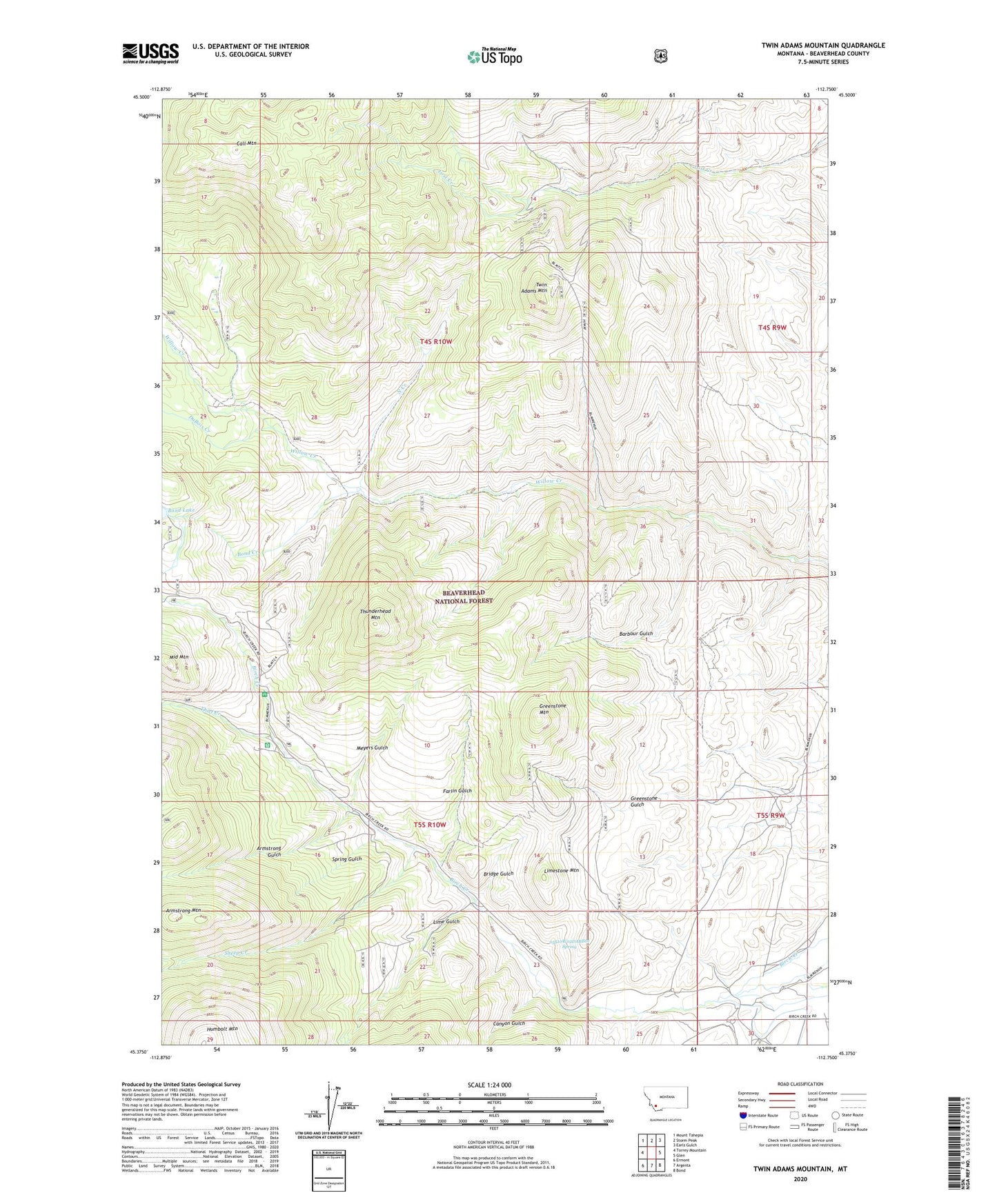
Twin Adams Mountain Montana US Topo Map
Couldn't load pickup availability
Also explore the Twin Adams Mountain Forest Service Topo of this same quad for updated USFS data
2024 topographic map quadrangle Twin Adams Mountain in the state of Montana. Scale: 1:24000. Based on the newly updated USGS 7.5' US Topo map series, this map is in the following counties: Beaverhead. The map contains contour data, water features, and other items you are used to seeing on USGS maps, but also has updated roads and other features. This is the next generation of topographic maps. Printed on high-quality waterproof paper with UV fade-resistant inks.
Quads adjacent to this one:
West: Torrey Mountain
Northwest: Mount Tahepia
North: Storm Peak
Northeast: Earls Gulch
East: Glen
Southeast: Bond
South: Argenta
Southwest: Ermont
This map covers the same area as the classic USGS quad with code o45112d7.
Contains the following named places: 05S10W02DABB01 Spring, Armstrong Gulch, Armstrong Mountain, Aspen Campground, Barbour Gulch, Barbour Gulch Mine, Birch Creek Ranger Station, Bond Creek, Bond Lake Dam, Bridge Gulch, Call Mountain, Canyon Gulch, Cow Camp, DuBois Creek, Farlin, Farlin Gulch, Farlin Post Office, Farlin School, Glowworm/Greenhorn Mine, Greenstone Mine, Greenstone Mountain, Indian Queen Mine, Lime Gulch, Lime Gulch Mine, Limestone Mountain, Lost Fraction Mine, Lower Bridge Gulch Mine, Meyers Gulch, Middle Mountain, North Creek, SE SW Section 16 Mine, Sheep Creek, Spring Gulch, Sugar Loaf Mine, Thief Creek, Thunderhead Mountain, Twin Adams Mine, Twin Adams Mountain, Upper Bridge Gulch Mine