MyTopo
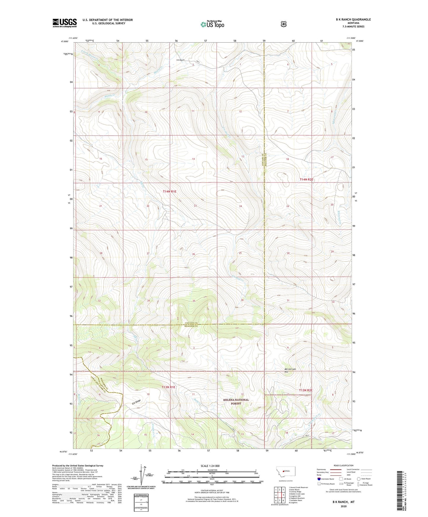
B K Ranch Montana US Topo Map
Couldn't load pickup availability
Also explore the B K Ranch Forest Service Topo of this same quad for updated USFS data
2024 topographic map quadrangle B K Ranch in the state of Montana. Scale: 1:24000. Based on the newly updated USGS 7.5' US Topo map series, this map is in the following counties: Meagher, Cascade, Lewis and Clark. The map contains contour data, water features, and other items you are used to seeing on USGS maps, but also has updated roads and other features. This is the next generation of topographic maps. Printed on high-quality waterproof paper with UV fade-resistant inks.
Quads adjacent to this one:
West: Middle Creek Lake
Northwest: Hound Creek Reservoir
North: Dana Ranch
Northeast: Conway Ridge
East: Lingshire NW
Southeast: Lingshire
South: Snedaker Basin
Southwest: Hogback Mountain
This map covers the same area as the classic USGS quad with code o46111h5.
Contains the following named places: B K Ranch, East Fork Hound Creek, Elk Creek, Elk Ridge, Middle Creek, Mil-mil-teh Hill, Wallace Post Office