MyTopo
Bailey Reservoir Montana US Topo Map
Couldn't load pickup availability
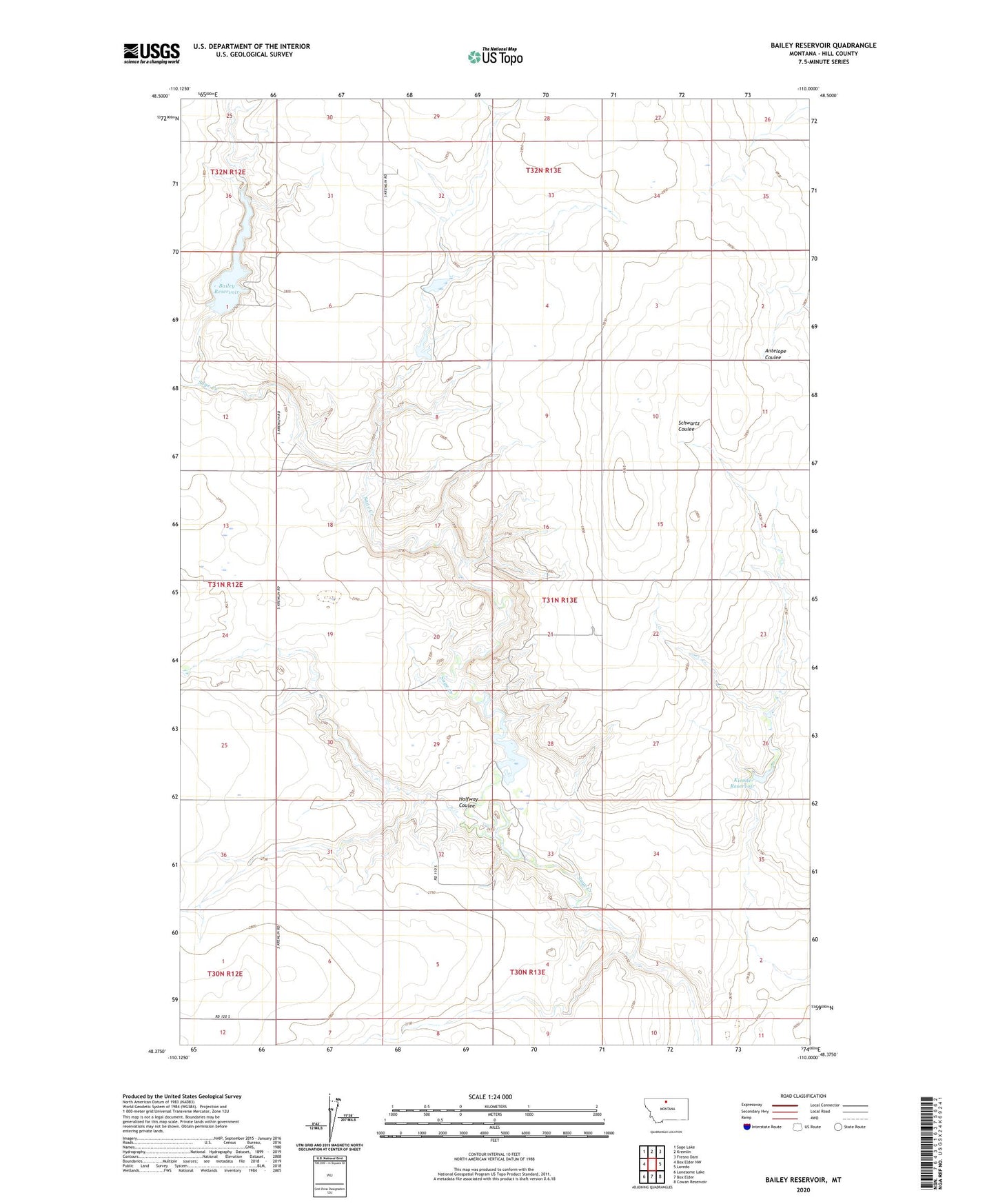
2024 topographic map quadrangle Bailey Reservoir in the state of Montana. Scale: 1:24000. Based on the newly updated USGS 7.5' US Topo map series, this map is in the following counties: Hill. The map contains contour data, water features, and other items you are used to seeing on USGS maps, but also has updated roads and other features. This is the next generation of topographic maps. Printed on high-quality waterproof paper with UV fade-resistant inks.
Quads adjacent to this one:
West: Box Elder NW
Northwest: Sage Lake
North: Kremlin
Northeast: Fresno Dam
East: Laredo
Southeast: Cowan Reservoir
South: Box Elder
Southwest: Lonesome Lake
This map covers the same area as the classic USGS quad with code o48110d1.
Contains the following named places: 31N13E32BAAA01 Well, Bailey Reservoir, Bailey-Dees-Frey Dam, Dees Brothers Dam, Halfway Coulee, Hilldale Colony Dam, Howard Goodian Dam, Kiemle Dam, Kiemle Reservoir