MyTopo
Fresno Dam Montana US Topo Map
Couldn't load pickup availability
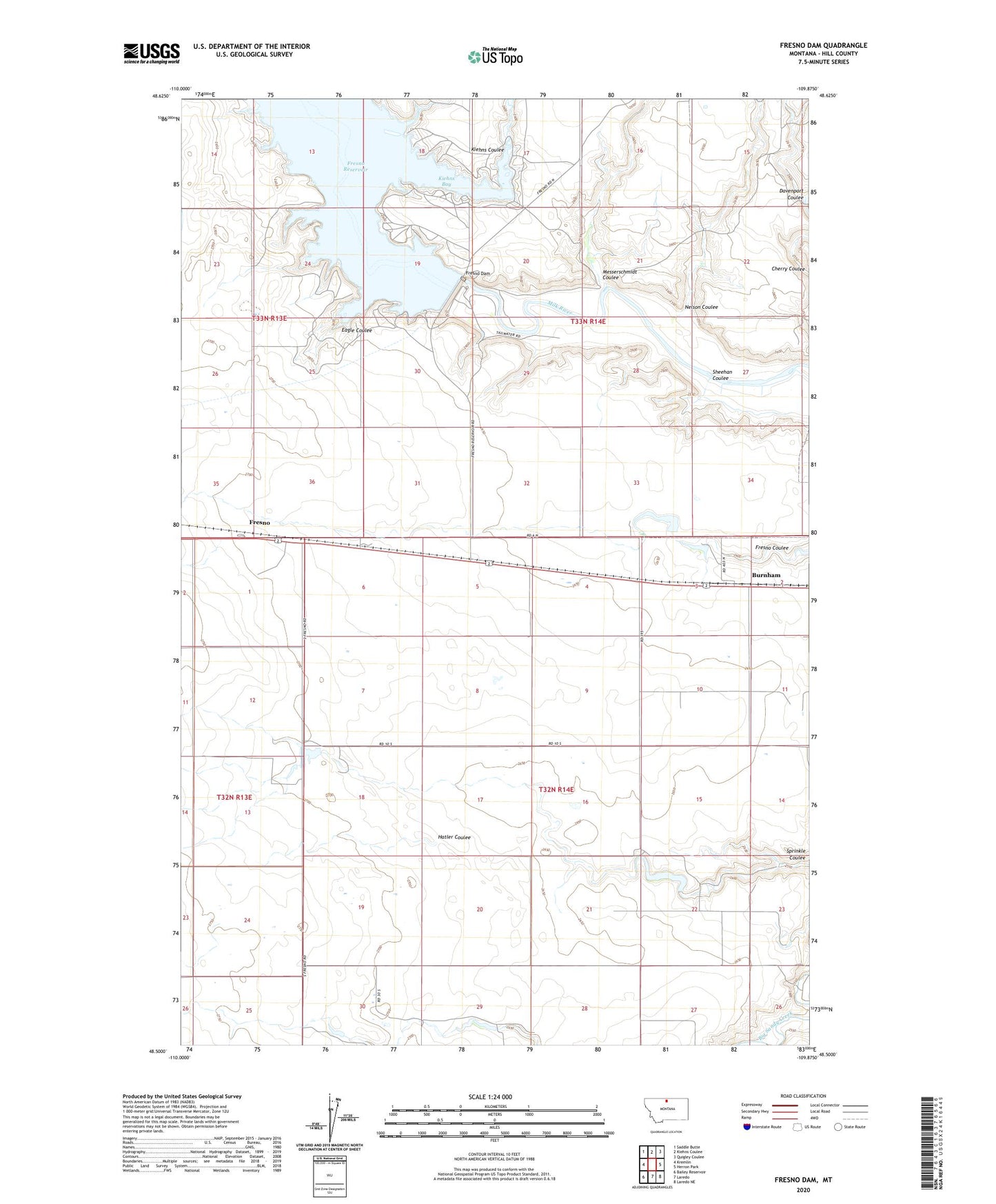
2024 topographic map quadrangle Fresno Dam in the state of Montana. Scale: 1:24000. Based on the newly updated USGS 7.5' US Topo map series, this map is in the following counties: Hill. The map contains contour data, water features, and other items you are used to seeing on USGS maps, but also has updated roads and other features. This is the next generation of topographic maps. Printed on high-quality waterproof paper with UV fade-resistant inks.
Quads adjacent to this one:
West: Kremlin
Northwest: Saddle Butte
North: Kiehns Coulee
Northeast: Quigley Coulee
East: Herron Park
Southeast: Laredo NE
South: Laredo
Southwest: Bailey Reservoir
This map covers the same area as the classic USGS quad with code o48109e8.
Contains the following named places: 32N14E04CCBC01 Well, Burnham, Burnham Post Office, Burnham School, California Coulee Dam, Davenport Coulee, Eagle Coulee, Fresno, Fresno Beach Campground, Fresno Dam, Fresno Post Office, Fresno School, Fresno Tailwater Fishing Access Site, Hatler Coulee, J Pasma Dam, Kiehns Bay, Kiehns Campground, Kiehns Coulee, Messerschmidt Coulee, Nelson Coulee, Rain Dancer Dam, River Run Campground, Sheehan Coulee