MyTopo
Bull Butte North Dakota US Topo Map
Couldn't load pickup availability
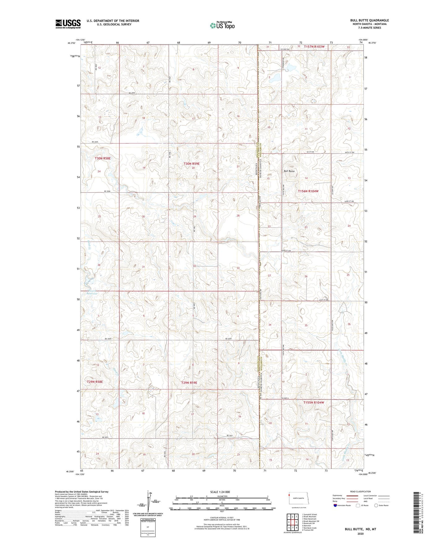
2024 topographic map quadrangle Bull Butte in the states of Montana, North Dakota. Scale: 1:24000. Based on the newly updated USGS 7.5' US Topo map series, this map is in the following counties: Williams, Roosevelt. The map contains contour data, water features, and other items you are used to seeing on USGS maps, but also has updated roads and other features. This is the next generation of topographic maps. Printed on high-quality waterproof paper with UV fade-resistant inks.
Quads adjacent to this one:
West: Brush Mountain SW
Northwest: Sunnyhill School
North: Brush Mountain
Northeast: West Bonetraill
East: Bonetraill SW
Southeast: Trenton NW
South: Red Bank Creek
Southwest: Bainville
This map covers the same area as the classic USGS quad with code o48104c1.
Contains the following named places: 29N59E09BDDB01 Well, Andy Capp Dam, Band Aid Dam, Bull Butte, Crusch School, Dwyer Post Office, Horab Dam, Johnson School, Lamar School, Picard Reservoir, Picard Reservoir Dam, Seventh Day Adventist Church