MyTopo
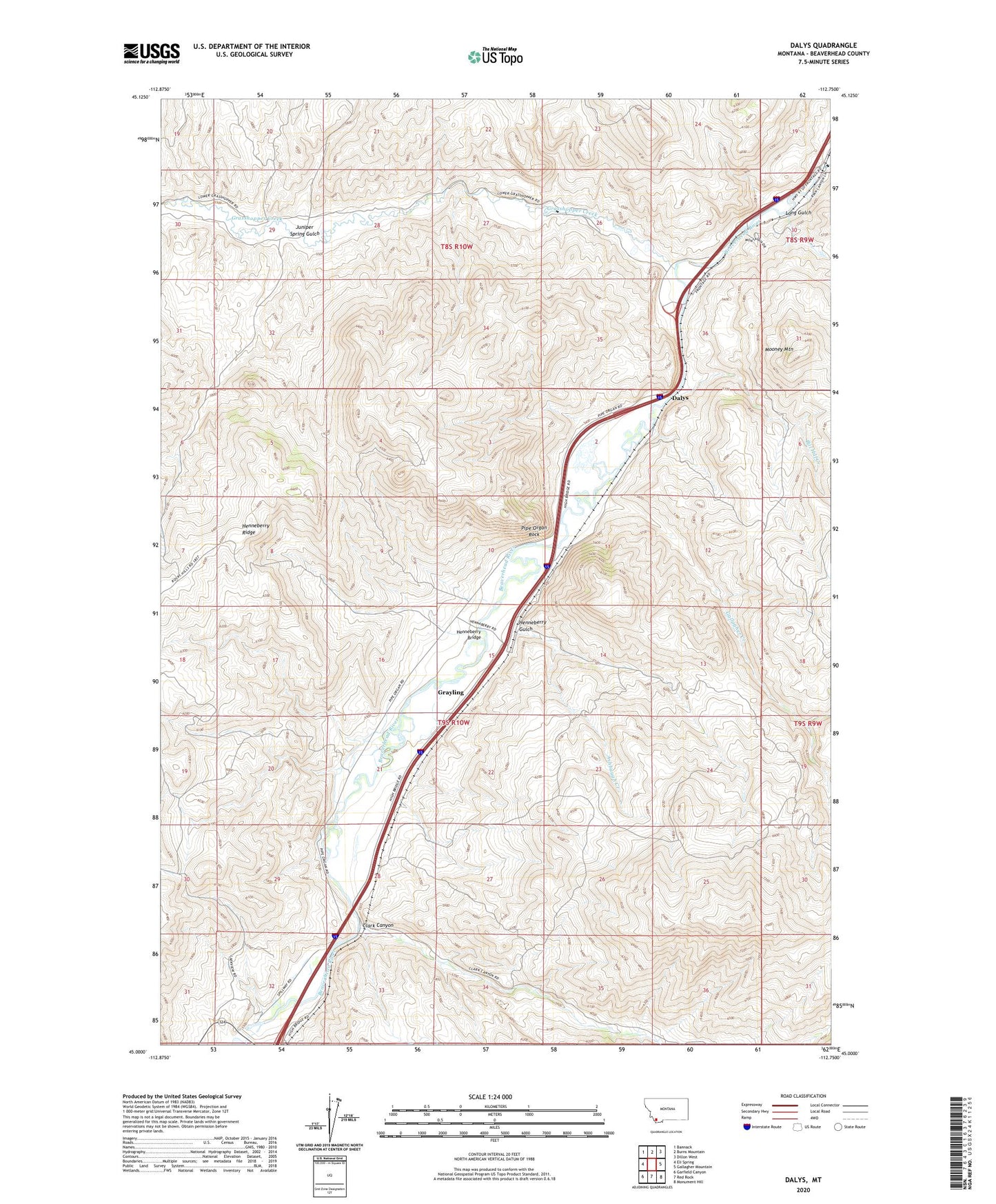
Dalys Montana US Topo Map
Couldn't load pickup availability
2024 topographic map quadrangle Dalys in the state of Montana. Scale: 1:24000. Based on the newly updated USGS 7.5' US Topo map series, this map is in the following counties: Beaverhead. The map contains contour data, water features, and other items you are used to seeing on USGS maps, but also has updated roads and other features. This is the next generation of topographic maps. Printed on high-quality waterproof paper with UV fade-resistant inks.
Quads adjacent to this one:
West: Eli Spring
Northwest: Bannack
North: Burns Mountain
Northeast: Dillon West
East: Gallagher Mountain
Southeast: Monument Hill
South: Red Rock
Southwest: Garfield Canyon
This map covers the same area as the classic USGS quad with code o45112a7.
Contains the following named places: Ashbaugh Creek, Beaver Head, Bill Hill Creek, Clark Canyon, Clark Canyon Dam, Corrals Fishing Access Site, Dalys, Gallagher Creek, Gallagher Creek Station, Grasshopper Creek, Grayling, Grayling School, Henneberry Bridge, Henneberry Fishing Access Site, Henneberry Gulch, Henneberry Ranch, High Bridge Fishing Access Site, Juniper Spring Gulch, Long Gulch, McMenomey Ranch, Middle Fork Gallagher Creek, Mooney Mountain, Mooney Ranch, Pipe Organ Lodge, Pipe Organ Rock, Rock, ZIP Code: 59725