MyTopo
Eli Spring Montana US Topo Map
Couldn't load pickup availability
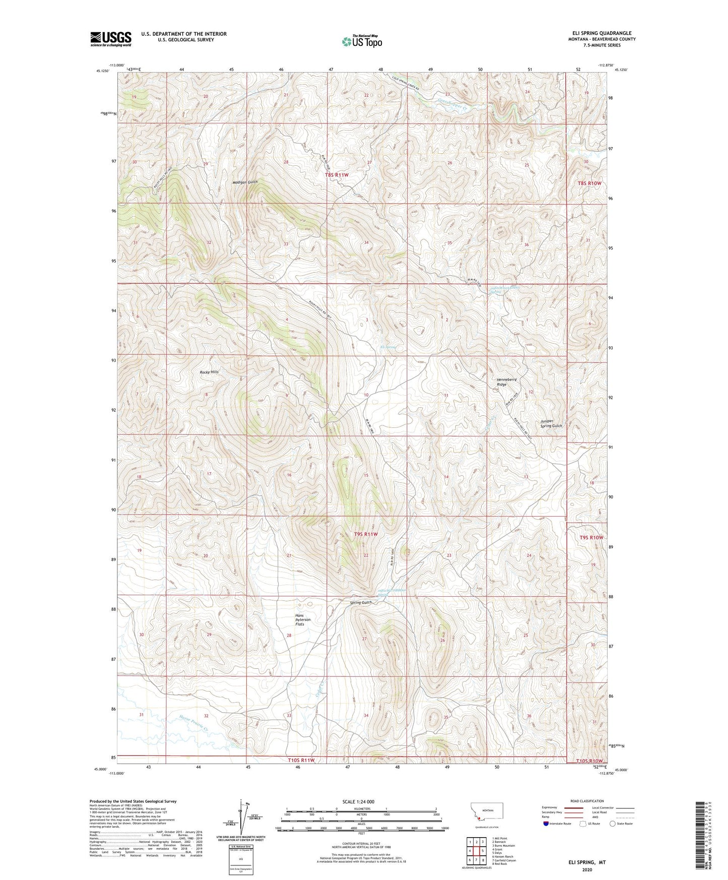
2024 topographic map quadrangle Eli Spring in the state of Montana. Scale: 1:24000. Based on the newly updated USGS 7.5' US Topo map series, this map is in the following counties: Beaverhead. The map contains contour data, water features, and other items you are used to seeing on USGS maps, but also has updated roads and other features. This is the next generation of topographic maps. Printed on high-quality waterproof paper with UV fade-resistant inks.
Quads adjacent to this one:
West: Grant
Northwest: Mill Point
North: Bannack
Northeast: Burns Mountain
East: Dalys
Southeast: Red Rock
South: Garfield Canyon
Southwest: Hansen Ranch
This map covers the same area as the classic USGS quad with code o45112a8.
Contains the following named places: 09S11W02AADD01 Spring, 09S11W27ABBD01 Spring, Cedar Creek, Eli Spring, Frenchie Place, Grasshopper Strip Mine, Hans Peterson Flats, Henneberry Ridge, Jerusalem, Rocky Hills, Spring Gulch