MyTopo
Bear Jaw Creek Montana US Topo Map
Couldn't load pickup availability
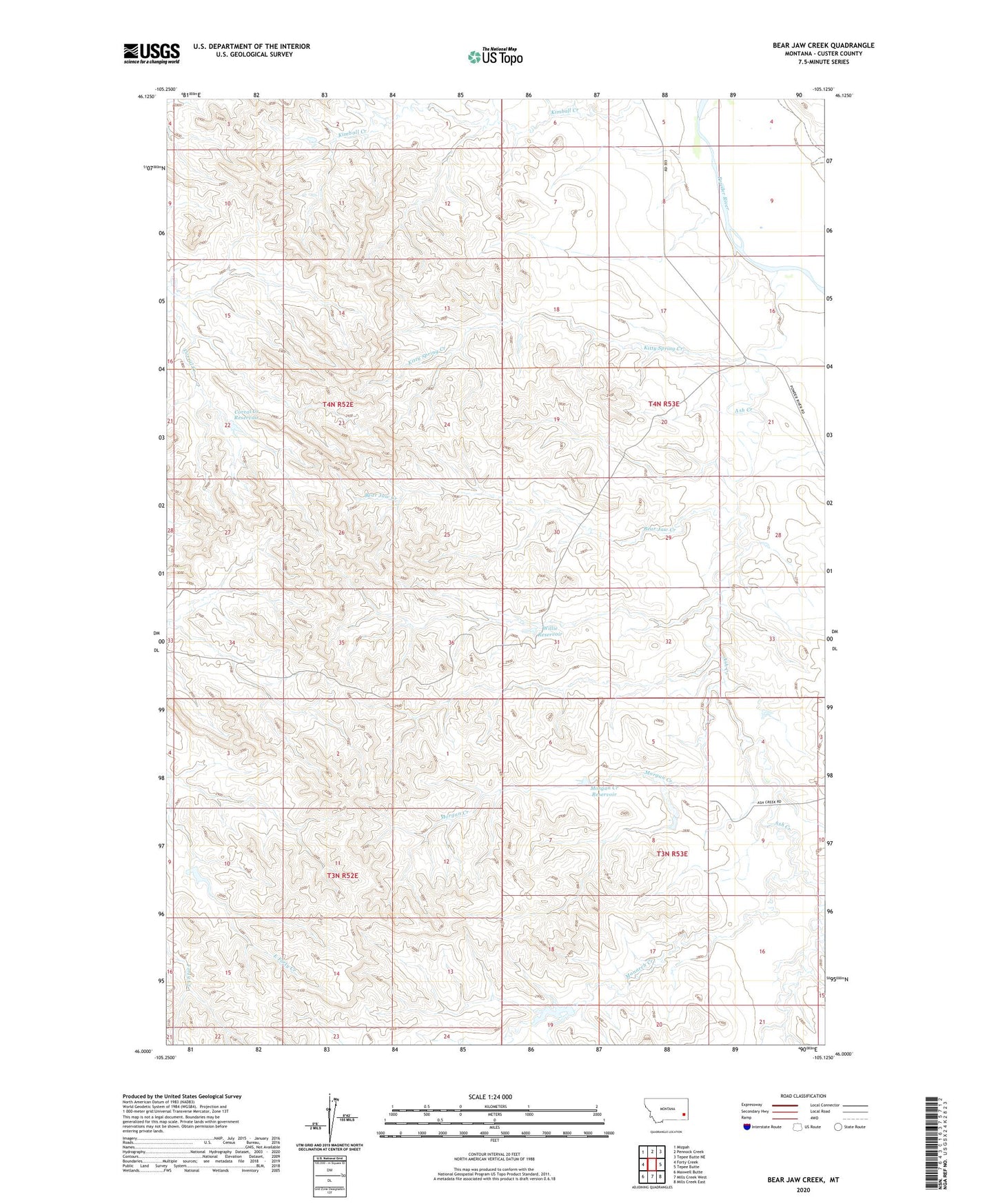
2020 topographic map quadrangle Bear Jaw Creek in the state of Montana. Scale: 1:24000. Based on the newly updated USGS 7.5' US Topo map series, this map is in the following counties: Custer. The map contains contour data, water features, and other items you are used to seeing on USGS maps, but also has updated roads and other features. This is the next generation of topographic maps. Printed on high-quality waterproof paper with UV fade-resistant inks.
Quads adjacent to this one:
West: Forty Creek
Northwest: Mizpah
North: Pennock Creek
Northeast: Tepee Butte NE
East: Tepee Butte
Southeast: Mills Creek East
South: Mills Creek West
Southwest: Maxwell Butte
Contains the following named places: 03N52E12BD__01 Well, 03S52E13CCC_01 Well, 04N52E01DDBD01 Well, 04N52E16AADD01 Well, 04N53E21BAA_01 Well, 04N53E30ACBA01 Well, Ash Creek, Bear Jaw Creek, Bear Jaw Windmill, Corral Creek Reservoir, Corral Creek Well, E Hardy Number 2 Dam, Kitty Spring Creek, Leidholt Reservoir Dam, Monarch Creek, Morgan Creek, Morgan Creek Reservoir, Willie Reservoir