
MyTopo
Bear Trap Creek Montana US Topo Map
Couldn't load pickup availability
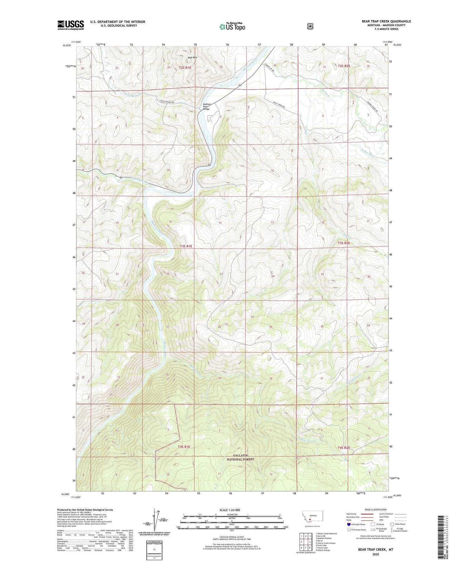
2020 topographic map quadrangle Bear Trap Creek in the state of Montana. Scale: 1:24000. Based on the newly updated USGS 7.5' US Topo map series, this map is in the following counties: Madison. The map contains contour data, water features, and other items you are used to seeing on USGS maps, but also has updated roads and other features. This is the next generation of topographic maps. Printed on high-quality waterproof paper with UV fade-resistant inks.
Quads adjacent to this one:
West: Norris
Northwest: Willow Creek Reservoir
North: Norris NE
Northeast: Madison Plateau
East: Cherry Creek Canyon
Southeast: Willow Swamp
South: Cherry Lake
Southwest: Ennis Lake
Contains the following named places: 03S01E02BDC_01 Well, 59745, Bear Trap Creek, Bear Trap Creek Mine, Bear Trap Creek Number 2 Mine, Beartrap Recreation Area, Cherry Creek, Cherry Creek School, Cold Spring Creek, Copper King Mine, Hot Springs Creek, Lee Metcalf Wilderness, Lewis Post Office, Madison River Bridge, Moore Ranch Number 1 Mine, Moore Ranch Number 2 Mine, Moore Ranch Number 3 Mine, Morning Star Mine, NE NW Section 21 Mine, NE NW Section 28 Mine, NE SE Section 21 Mine, NW NE Section 15 Mine, Pole Creek, Red Mountain, Savannah Ridge Mine, Stephens Ranch


