MyTopo
Ennis Lake Montana US Topo Map
Couldn't load pickup availability
Also explore the Ennis Lake Forest Service Topo of this same quad for updated USFS data
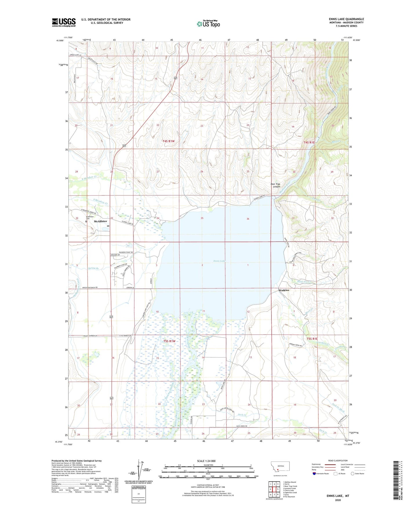
2024 topographic map quadrangle Ennis Lake in the state of Montana. Scale: 1:24000. Based on the newly updated USGS 7.5' US Topo map series, this map is in the following counties: Madison. The map contains contour data, water features, and other items you are used to seeing on USGS maps, but also has updated roads and other features. This is the next generation of topographic maps. Printed on high-quality waterproof paper with UV fade-resistant inks.
Quads adjacent to this one:
West: Leonard Creek
Northwest: Maltbys Mound
North: Norris
Northeast: Bear Trap Creek
East: Cherry Lake
Southeast: Fan Mountain
South: Ennis
Southwest: Eightmile Creek
This map covers the same area as the classic USGS quad with code o45111d6.
Contains the following named places: 04S01W35AADD01 Well, 05S01W03ACCC01 Well, 05S01W04ABDD01 Well, 05S01W04ACBC01 Well, 05S01W04BAAB01 Well, 05S01W04DBAB01 Well, 05S01W04DDDB01 Well, 05S01W10BADC01 Well, 05S01W17AAAA01 Well, 05S01W21CCCC01 Well, 05S01W21DCDB01 Well, 05S01W23CCBD01 Well, 05S01W23DABA01 Well, 05S01W28BCAB01 Well, Barn Creek, Bear Trap Canyon, Cedar Creek, Cedar Hills Ranch, Crooked Creek, Ennis Lake, Ennis Lake Recreation Site, Fall Creek, Fletcher Channel, Fletcher Creek, Harris Inn, Jack Creek, Jourdain Creek, Lake Shore Cabins and Campground, Lake Shore Lodge, Madison Dam, Madison Powerhouse, McAllister, McAllister Cemetery, McAllister Census Designated Place, McAllister Church, McAllister Post Office, McAllister School, Meadow Lake Camp, Meadow Lake Fishing Access Site, Meadow Lake Recreation Site, Moore Creek, North Meadow Creek, Old Madison Powerhouse, Saint Joe Creek, Shelhamer Ranch, Short Creek, South Meadow Creek, Spalding Post Office, Spring Branch, Spring Creek, Trail Creek, Valley Garden Campground, Valley Garden Ranch, Watkins, West Madison Canal, Windy Water Resort