MyTopo
Norris Montana US Topo Map
Couldn't load pickup availability
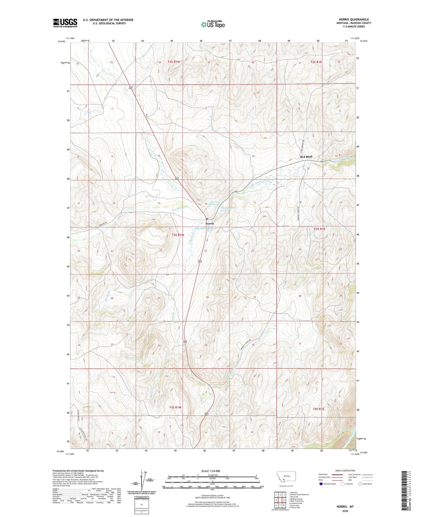
2024 topographic map quadrangle Norris in the state of Montana. Scale: 1:24000. Based on the newly updated USGS 7.5' US Topo map series, this map is in the following counties: Madison. The map contains contour data, water features, and other items you are used to seeing on USGS maps, but also has updated roads and other features. This is the next generation of topographic maps. Printed on high-quality waterproof paper with UV fade-resistant inks.
Quads adjacent to this one:
West: Maltbys Mound
Northwest: Harrison
North: Willow Creek Reservoir
Northeast: Norris NE
East: Bear Trap Creek
Southeast: Cherry Lake
South: Ennis Lake
Southwest: Leonard Creek
This map covers the same area as the classic USGS quad with code o45111e6.
Contains the following named places: 03S01W14DAB_01 Well, 03S01W14DAB_02 Well, 03S01W14DABA01 Spring, 03S01W23ABAB01 Spring, 03S01W23ABBB01 Well, Audrey Mine, Barter Ranch, Baush Mine, Bear Trap Hot Springs, Beartrap Hot Springs Campground, Billy Mine, Black Rock Extension Mine, Boaz Mine, Bozeman Trail Historical Marker, Bradley Creek, Burnt Creek, Easter Shaft, Golconda Mine, Grubstake Mine, Headlight Mine, Helene Mine, Helene-Birdia Mine, Jackson Dam, Jackson Ranch Mine, Mary Lee Mine, Michels Ranch Mine, Montana Boy Mine, Moore Ranch Number 4 Mine, MSU Adit Mine, NE SE Section 7 Mine, Norris, Norris Census Designated Place, Norris Post Office, Norris School, Peanut Mine, Red Bluff, Red Bluff North Mine, Red Bluff Post Office, Red Bluff School, Red Chief Mine, Rice Ranch Mine, Rosebud Mine, SE NE Section 12 Mine, SE NE Section 24 Mine, SE SE S13/NE NE S24 Mine, Sleepy Jim Mine, SW NW Section 25 Mine, The Mound, Tobacco Root Mine, Water/Mohegan Mine, Waterlode Mine, Woods Creek