MyTopo
Dead Boy Divide Montana US Topo Map
Couldn't load pickup availability
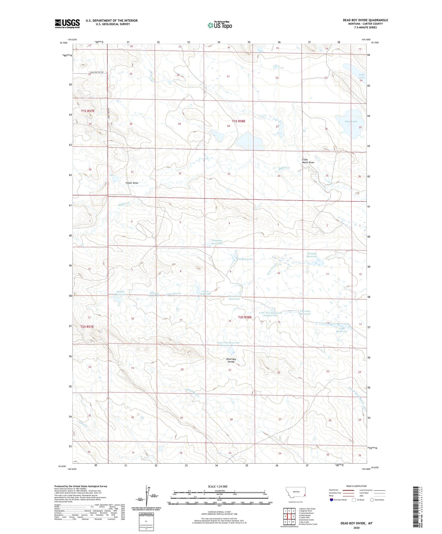
2024 topographic map quadrangle Dead Boy Divide in the state of Montana. Scale: 1:24000. Based on the newly updated USGS 7.5' US Topo map series, this map is in the following counties: Carter. The map contains contour data, water features, and other items you are used to seeing on USGS maps, but also has updated roads and other features. This is the next generation of topographic maps. Printed on high-quality waterproof paper with UV fade-resistant inks.
Quads adjacent to this one:
West: Chalk Buttes
Northwest: Beaver Flats South
North: Stagville Draw
Northeast: Camp Needmore
East: Taylor Hills
Southeast: School Section Creek
South: Ikey Creek
Southwest: Dutchman Creek
This map covers the same area as the classic USGS quad with code o45104f5.
Contains the following named places: 01S57E24DAA_01 Well, Apache Dam, Apache Reservoir, Blackfoot Dam, Blackfoot Reservoir, Cherokee Reservoir, Cheyenne Detention Dam, Cheyenne Reservoir, Cline Number 2 Dam, Cline Number 3 Dam, Dead Boy Divide, Foster Draw, Fresh Water Draw, Gros Ventre Dam, Gros Ventre Reservoir, Lone Tree Reservoir Dam, Lone Tree Reservoir Number One, Lone Tree Reservoir Number Two, Long Dam, Long Reservoir, Navaho Dam, Navaho Reservoir, Prairie Dale, Sioux Reservoir, Soda Lakes, Ute Dam, Ute Reservoir, Wichiup Reservoir