MyTopo
Chalk Buttes Montana US Topo Map
Couldn't load pickup availability
Also explore the Chalk Buttes Forest Service Topo of this same quad for updated USFS data
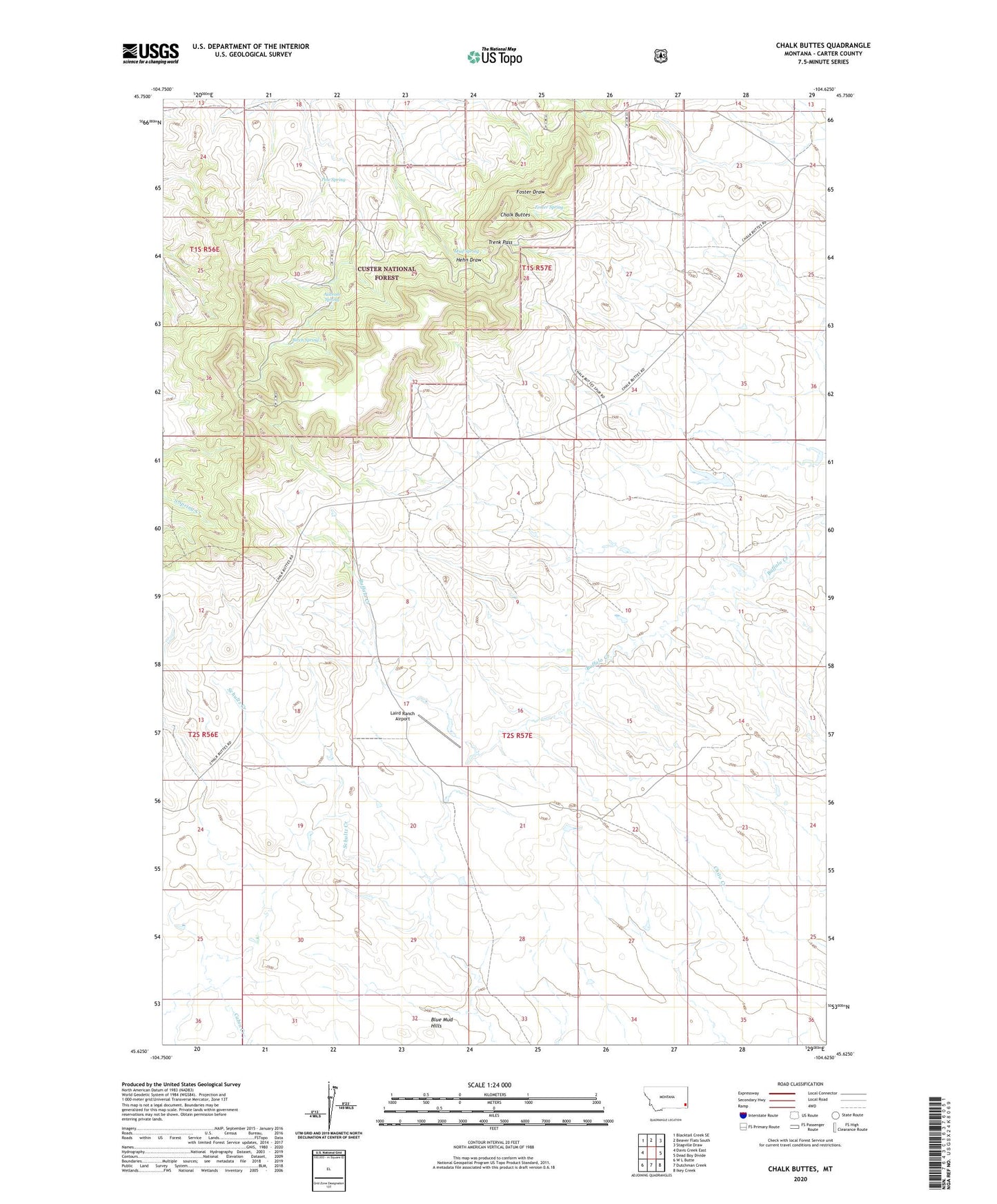
2024 topographic map quadrangle Chalk Buttes in the state of Montana. Scale: 1:24000. Based on the newly updated USGS 7.5' US Topo map series, this map is in the following counties: Carter. The map contains contour data, water features, and other items you are used to seeing on USGS maps, but also has updated roads and other features. This is the next generation of topographic maps. Printed on high-quality waterproof paper with UV fade-resistant inks.
Quads adjacent to this one:
West: Davis Creek East
Northwest: Blacktail Creek SE
North: Beaver Flats South
Northeast: Stagville Draw
East: Dead Boy Divide
Southeast: Ikey Creek
South: Dutchman Creek
Southwest: W L Butte
This map covers the same area as the classic USGS quad with code o45104f6.
Contains the following named places: 01S57E19BBAA01 Well, 01S57E26ADCA01 Well, 01S57E32DCC_01 Well, 01S57E34BAD_01 Well, 01S57E34BDD_01 Well, 01S57E34BDD_02 Well, 02S56E01BCC_01 Well, 02S56E13BDDC01 Well, 02S56E23DAD_01 Well, 02S57E04ABBB01 Well, 02S57E07BDCC01 Well, Alstrom Spring, Birch Spring, Blue Mud Hills, Bradshaw School, Chalk Buttes, Chalk Buttes Post Office, Foster School, Foster Spring, Haycreek Mini-Mute Radar Site, Laird Ranch, Laird Ranch Airport, Mud Spring, Pete Spring, Trenk Pass, Trenk Reservoir