MyTopo
Mine Gulch Montana US Topo Map
Couldn't load pickup availability
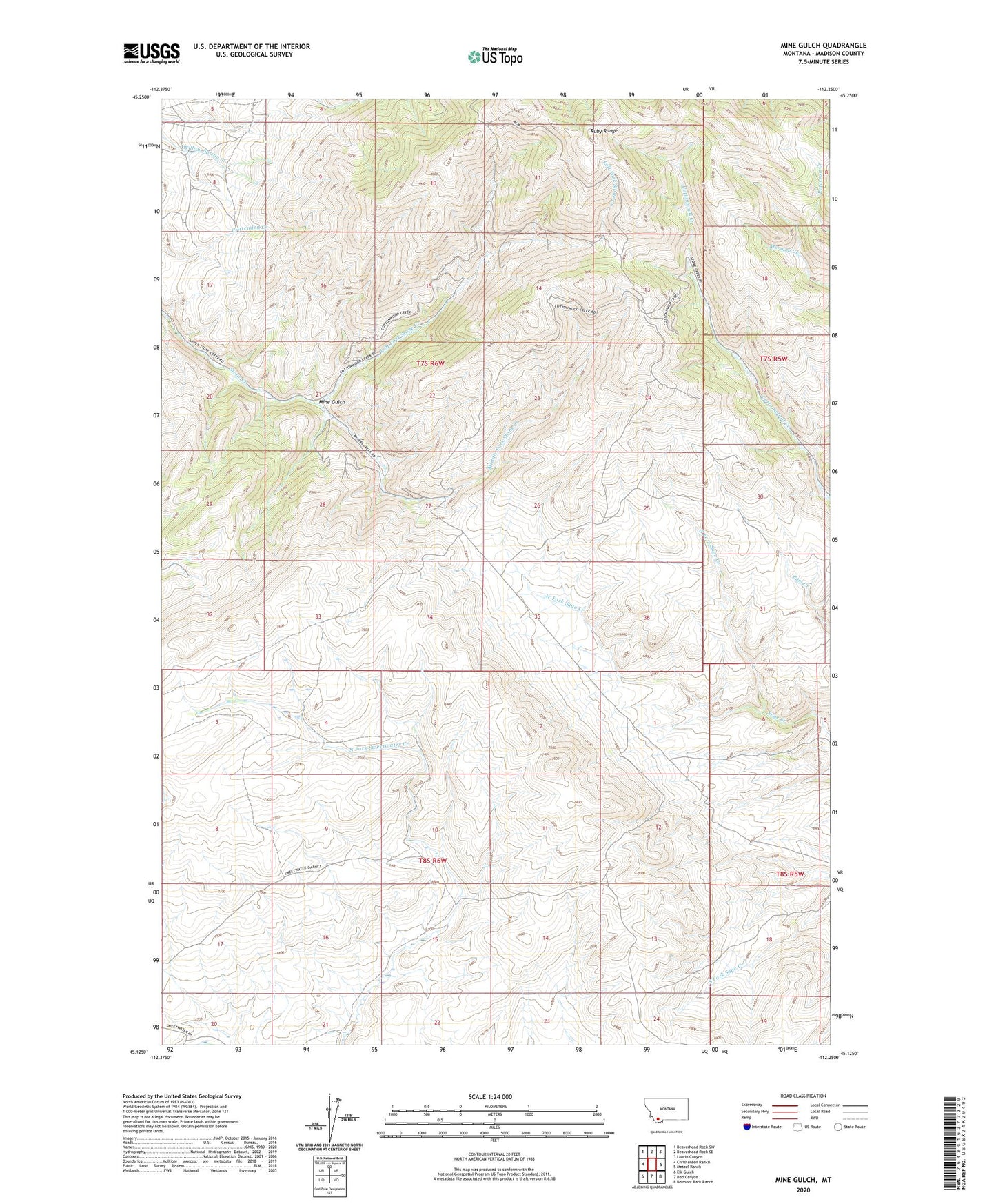
2024 topographic map quadrangle Mine Gulch in the state of Montana. Scale: 1:24000. Based on the newly updated USGS 7.5' US Topo map series, this map is in the following counties: Madison. The map contains contour data, water features, and other items you are used to seeing on USGS maps, but also has updated roads and other features. This is the next generation of topographic maps. Printed on high-quality waterproof paper with UV fade-resistant inks.
Quads adjacent to this one:
West: Christensen Ranch
Northwest: Beaverhead Rock SW
North: Beaverhead Rock SE
Northeast: Laurin Canyon
East: Metzel Ranch
Southeast: Belmont Park Ranch
South: Red Canyon
Southwest: Elk Gulch
This map covers the same area as the classic USGS quad with code o45112b3.
Contains the following named places: Left Fork Stone Creek, Middle Fork Stone Creek, Mine Gulch, Mine Gulch Mine, North Fork Sage Creek, Ruby Range, Sierra Strip Mine, Stone Creek Mine, Tri-State Strip Mine, West Fork Sage Creek